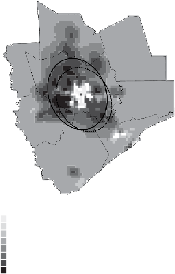
Geography Reference
In-Depth Information
Change in density
inh./km
2
Standard deviation Ellipse
of population 1970
-2,430 - -500
-500 - -50
-50 - 0
0 - 50
50 - 100
100 - 300
300 - 1,000
1,000
Standard deviation Ellipse
of population 2000
County
Methodology: Map created by Kernel density smoothing of
the Block Group's Population.
Quartic Function in a bandwidth of the 30 nearest
neighbours.
Calculated difference in density 1970 - 2000
- 4,150
Source: US Census
Designed and made by JM Zaninetti, University of Orleans, CEDETE Institute
Figure 8.25.
Houston, urban sprawl, 1970-2000