Geology Reference
In-Depth Information
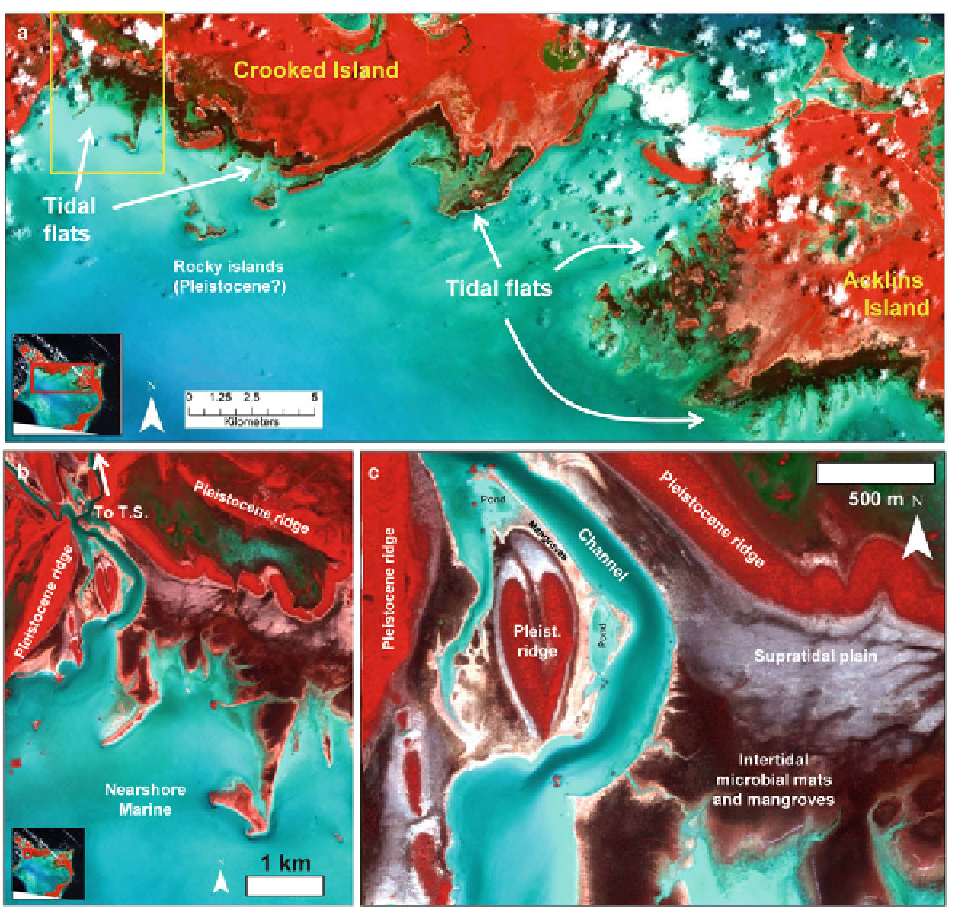
Fig. 19.11
Geomorphic characteristics and setting of the tidal fl ats
of part of the Crooked-Acklins Platform, illustrated in false-color
(NIR-G-B) remote sensing images. (
a
and
b
) General character of
tidal fl ats fl anking the southern margin of Crooked Island, including
a general zonation that includes Pleistocene outcrops, a supratidal
pavement, microbial marshes, and mangoves, with relatively few
creeks. (
c
) Detail of one area near the creek, illustrating consider-
able variability (Remote sensing images copyright DigitalGlobe)
soft
Scytonema
mats and scattered cemented crusts; it
grades landward into terrestrial environments.
north and west by Pleistocene ridges, 3-5 m high, and
platformward by a broad, shallow, subtidal nearshore
region (Fig.
19.11
) (Rankey and Reeder 2010). A con-
spicuous feature of this system is the paucity of well-
developed tidal channels. A single, deep (>2 m) tidal
channel occurs near the western margin of the tidal
fl ats, forming the only marine conduit through
Pleistocene outcrops to an otherwise landlocked shal-
low embayment (locally known as Turtle Sound)
(Fig.
19.11b
). The broad, irregular, supratidal plain of
19.3.2.4 Tidal Flats, Crooked-Acklins
Platform, Bahamas
Tidal fl ats form a continuous band 1-2 km wide and
~18 km long on the southern (platformward) fl ank of
Crooked Island, and exhibit geomorphic patterns
distinct from those on Andros Island or the Caicos
platform (Fig.
19.11
). The tidal fl ats are bound to the