Geology Reference
In-Depth Information
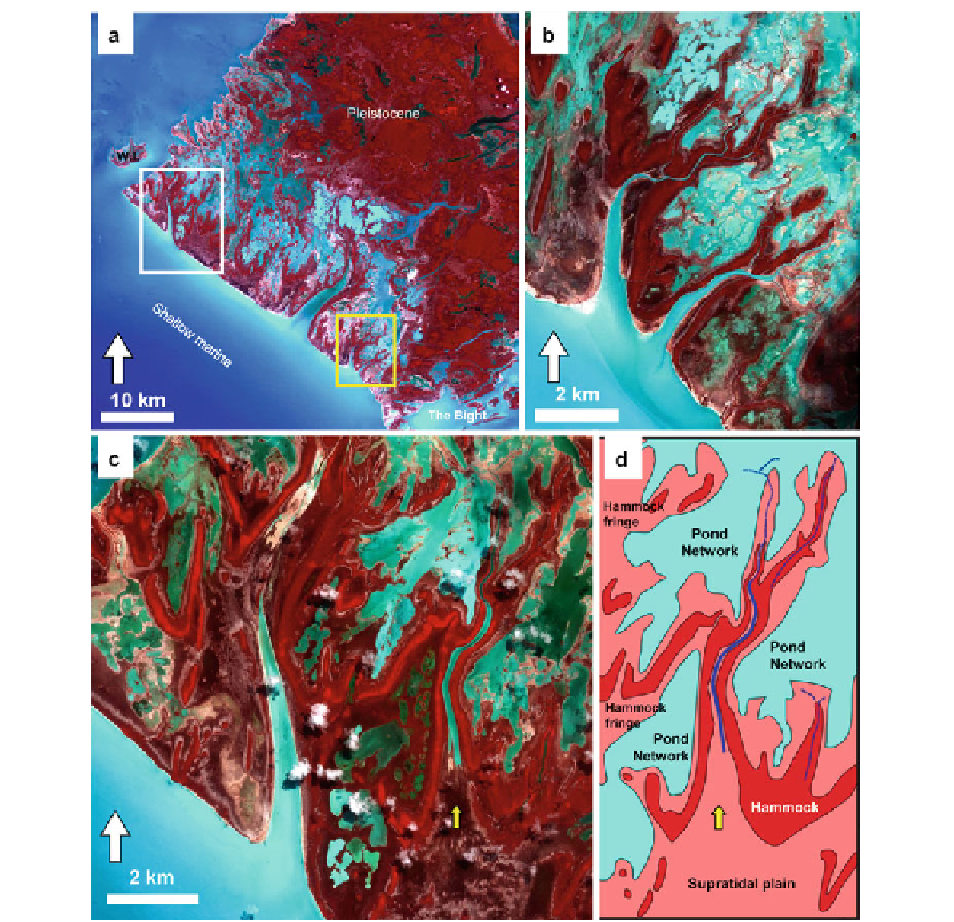
Fig. 19.8
Geomorphic characteristics of the tidal fl ats of parts
of southwest-facing Andros Island. (
a
-
c
) False-color (NIR-G-B)
remote-sensing images. In these images,
redder
areas indicate
denser vegetation. (
a
) Overview image. Note the broad tidal-fl at
complex, with an irregular northwest-facing coast and a straight
southwest-facing coast with relatively few tidal creeks. “W.I.”
indicates the location of Williams Island, “The Bight” refers to
the narrow passage through central Andros. (
b
) Remote sensing
image of part of the southeastern expanse of the tidal fl at (
yellow
box
in
a
). In this area, the shallow creeks are fl anked by levees
with dense vegetation, and the more inland areas include shallow
ponds and mudbanks. (
c
-
d
) Remote sensing image (
c
) and
simplifi ed interpretive sketch (
d
) of an area southeast of Williams
Island (
white box
in
a
). Here, regions near the coast include a
broad supratidal plain and palm hammocks. These pass landward
(northeast) into a complex of ponds and linear hammocks with
morphology akin to the levee fl anks on creeks further southeast
(see area in
b
).
Yellow arrow
points to the same closed creek
mouth in both parts (Remote sensing images (
b
) and (
c
) copy-
right GeoEye.com)
Within the broad tidal fl at of southwest Andros
Island, several elongate to V-shaped ridges are present
(Fig.
19.8c, d
). These ridges presently support cabbage
palms, grasses, and several are fl anked by dolomitic
crusts (“runways” Shinn et al.
1965
) (Fig.
19.6e, f
).
These ridges are aligned normal to the coast, with long
'tails' that extend landward. In several places, two or
more parallel ridge lines appear (Fig.
19.8c, d
). By