Geology Reference
In-Depth Information
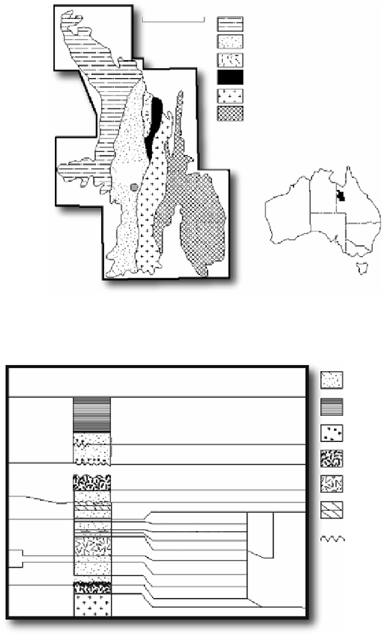
MOUNT ISA INLIER
Lawn Hill Platform
Leichhardt River Fault Trough
100 km
Ewen Block
Myally Shelf
Kalkadoon-Leichhardt Belt
Eastern Fold Belt
Mount
lsa
NT
QLD
WA
SA
NSW
VIC
TAS
Fig. 15.3
Location map showing the tectonic framework of the Mount Isa Inlier, Queensland, Australia (Based on Blake
1987
)
Leichhardt River
Fault Trough
Deformation and regional metamorphism
1610-1510 Ma
Sandstone
Siltstone-shale
1670+/
20 Ma
Moun lsa Group
Conglomerate
Surprise Creek Formation
Felsic volcanics
1670-1700 Ma
Granites
1678+/
1 Ma
Mafic volcanics
Bigie Formation
Quilalar Formation
Police Creek Siltstone
Whitworth Quartzite
Bortala Formation
Alsace Quartzite
Eastern Creek Volcanics
Upper Mount Guide Quartzite
Lower Mount Guide Quartzite
Bottletree Formation
Cover Sequence
Basement
Dolomite with siltstone
and sandstone
Unconformity
1790-1810 Ma
> 1860
(> 1900)
Fig. 15.4
Generalized lithostratigraphic column of cover rocks in the Leichhardt River Fault Trough of the Mount Isa Inlier (Based
on Blake
1987
). Note the position of the Upper Mount Guide Quartzite in the Haslingden Group