Geoscience Reference
In-Depth Information
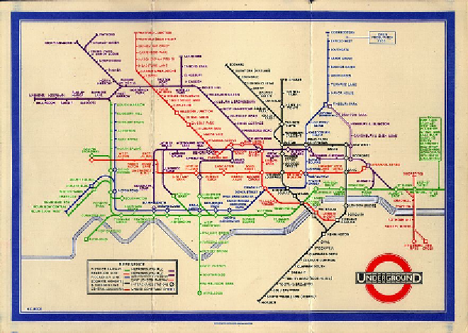
Figure 3:
Beck's map - first edition, 1933.
Source:http://www.ltmuseum.co.uk/omnibus/pg/1919b.htm#
This example illustrates how reality (here, the reality of travelling under-
ground) is sometimes better depicted if diagrams (non-realistic maps) are
used in preference to geographically correct maps. For the first-time visitor
to London, and perhaps also for some long-time London dwellers, their
composite mental map of London underground - that place underground -
becomes clear from the first viewing of this geographical artefact.
5.3 Drawings - representations of naive geographies
Can users 'fuse' together an image of an entire city, and how it works,
from 'main-stream' maps and diagrams and, is that fused mapping image
true and accurate? Do these 'simple', but effective, graphic communication
devices provide just one window into reality? And, do naive users com-
pose an image of the world when using this graphic window that is not a
true image of reality? Or, is something else better?
In some instances a diagram, or cartoon-like drawing can be a better com-
municator of geography. This is especially true when individuals only have