Geoscience Reference
In-Depth Information
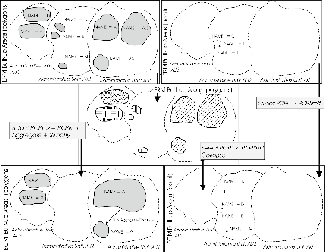
Additional information is given for the Built-up area generalisation in
Figure 7
. A Built-up area may consist of a number of polygons that can be
grouped based on the name. However, more than one Built-up area in
Europe may have the same name. In order to select the correct polygons,
additional information regarding their relative spatial position is needed.
This information is provided by the Administrative unit code of the lower
hierarchical level that each Built-up area belongs to. A special field is
created that holds the Administrative unit code and the name of the build-
up area. This field works as an identifier and is used in any Built-up Area
selection statement (
Figure 7
).
Figure 7:
ERM Built-up area (polygon) dataset generalisation results to EGM Built-up area
(polygon) dataset and Built-up area (point) dataset. ERM Built-up area (point) dataset
generalisation results to EGM Built-up area (point) dataset
3.4 Implementation
The above described generalisation plan has been implemented in the
ESRI ArcGIS environment. ERM data are stored in a file geodatabase. The