Geoscience Reference
In-Depth Information
4- The MAS-based generalization model
4.1 Definition of terrain features
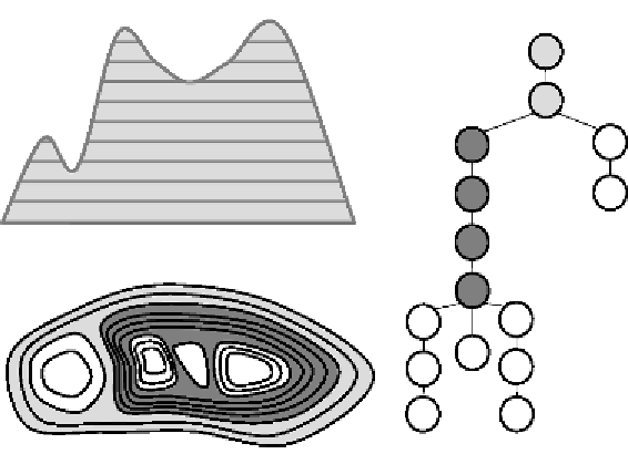
As it appears through the expressions of cartographic constraints, isobath
generalization is driven by the types of morphometric features on the sea-
bed and so their identification is required. Morphometric features from a
contour map are usually extracted by building the contour tree based on
inclusion relationships between the contours (Cronin 1995). Two kinds of
features are extracted: peaks and pits, which correspond to the branches of
peaks or pits. However, the description of a landscape also depends on the
scale of observation and interpretation from the user. Identifying the
branches of the tree only yields a description of features at the highest
level of detail. Other features of larger size can be identified by the user
depending on his interest (
Figure 6
). These different features can be identi-
fied and stored in a feature tree as, like contours, they can be connected
based on their inclusion relation.
Figure 5:
Contour tree corresponding to a contour map