Geoscience Reference
In-Depth Information
3.2.2 Results for the Printed Maps
The questionnaire for the printed maps included questions concerning the
four different maps provided as well as general questions on what kind of
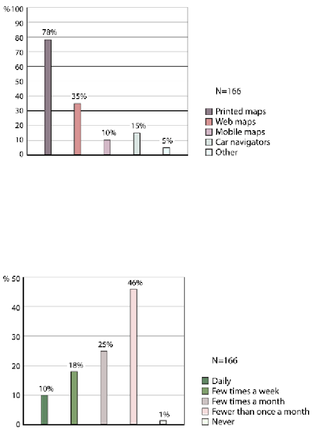
We analysed a total of 166 questionnaires.
Figure 7:
The types of maps the participants preferred to use
In
Figure 7
it can be seen that printed maps are the most popular types of
map, with web maps being second. The category other maps (5%) refers to
for example GPS devices.
Fig. 8
shows how often the participants use
maps. Most of them reported that they use any kind of maps fewer than
once a month.
Figure 8:
The frequency of map usage by the participants