Geoscience Reference
In-Depth Information
3- Results
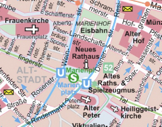
For the tourism scenario an A2 city map of Munich, Germany has been
designed that will interact with a digital map. To avoid problems due to
different underlying map projections in the paper and digital map, Open-
StreetMap is chosen as source of map data both for the printed map as well
as for the electronic device. Since the intention is to have a map that can be
printed with Anoto pattern on regular laser printers without special ink, the
map design had to be adjusted. To find out which map contents interfere to
what extend with the pattern a vector version of an existing city map has
been taken for testing and has been adjusted in an iterative manual process.
In a first test print critical areas on the map were identified where the map
information obscures the Anoto pattern making it unreadable for the pen.
In order to minimize this effect some or all of the following measures
needed to be performed for these map areas: lightening of the background
color, replacing of black and grey in labels, signatures and contours with
blue or pale purple or omitting it where possible, reduction of the font
weight, decluttering of labels and signatures. For some sections this proc-
ess had to be repeated after the readability of the pattern had been checked
again since one did not want to omit too much information of the map in
one step. The resulting map compared with its original can be seen in
figure. 3.a
and
3.b
. The lessons learned from this process give guidance when
developing a special map design based on OpenStreetMap.
Figure 3.a:
Original map design (Colin and Dittmann 2005)