Geoscience Reference
In-Depth Information
5- Embedding the ATB map component in a GIS-VIS production
environment
The integration of the ATB map component is part of an ongoing R&D
project funded by the German ministry of economics and technology. In
the project a main objective of this collaboration is the development of a
fully integrated GISVIS environment for commercial map and atlas pro-
duction. One particular goal of our research efforts in this context is to im-
plement rule-based, automated quality map construction in the production
process. All collaborators are aware of the fact that full integration of the
VIS component into one complex GIS-based system is a challenging task.
However, the lack of integration of the GIS and VIS components, resulting
in suboptimal map graphics as mentioned above, has also found the atten-
tion of commercial GIS developers (Buckley et al. 2005, Hardy 2009). A
major breakthrough, supporting map generation in line with the princples
of adequate map visualisation, has not been achieved yet.
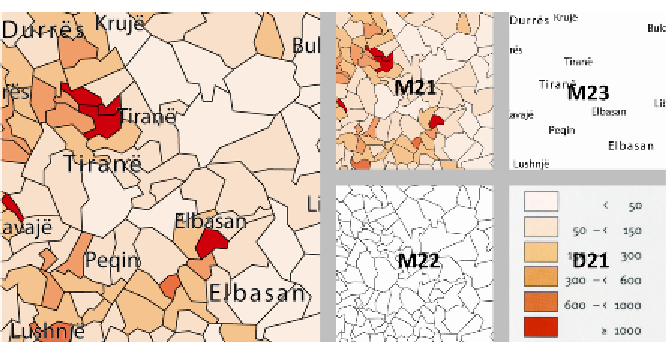
Figure 5:
Map patterns compiled from characteristic combinations of stacks, cards and
elements, exemplified for the construction of a typical choropleth atlas map: population
density. Source: Demographic Atlas of Albania (Bërxholi et al. 2003)
Once finalised, the successful development and implementation of an inte-
grated GISVIS production environment will significantly enhance the carto-
graphic quality of map visualisations and provide consistent production
quality throughout map and atlas production, respectively. At the same
time investments in cost and time will substantially be reduced - this time
not at the expense of map quality. From a professional cartographer's