Geoscience Reference
In-Depth Information
6- Visualisations, maps with dynamic content and self-generated
maps
6.1 Visualisations
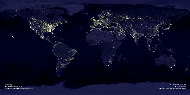
Visualisations of the Earth allow instant access to what is happening in a
space. We are well used to seeing montages of scenes of the Earth by
night, where, by capturing images of city light, areas of intense popula-
tions can be seen. The image below is typical of this type of product,
showing the Earth by night. Areas of intense populations can be clearly
seen due to the intensity of the light being emitted from different conti-
nents and regions.
Figure 7:
The Earth at night, November 27, 2000. Source: Astronomy picture of the Day.
http://antwerp.gafe.nasa.gov/apod/astropix.html
6.2 Maps with dynamic content
An example of a map with dynamic content that provides global informa-
tion is the Star Alliance animated map (
Figure 8
). The airline alliance pro-
vides a screen saver that shows one day's aircraft movements for all of the
flights operated by member companies of the alliance. Readers are able to
see the global coverage of the Alliance members and appreciate how inter-