Environmental Engineering Reference
In-Depth Information
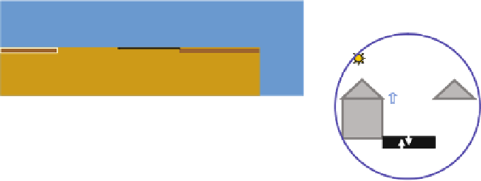
(b)
(a)
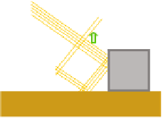
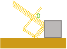
Plate 7
Examples of CFD application to realistic urban geometries.
(a)
Contour map of instanta-
neous surface wind in Sinjuku (from Kanda, 2006c), and
(b)
contour map of instantaneous surface
temperature field and surface wind vector at a coastal area in Tokyo (from Ashie et al., 2005). The
area is 500 m
×
500 m for
(a)
and
(b)
(See also Figure 5.1 on page 41)
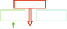
Net radiation Rn
Net radiation Rn
Anthropogenic heat
Qanth
Sensible heat
Hsens
Latent heat LE
(evapotranspiration)
Stored heat Gs
(conduction)
(roof)
(roof)
(vega)
(vega)
(vegn)
(vegn)
(water)
(water)
(pav)
(pav)
(bare)
(bare)
(cova)
(cova)
(nat)
(nat)
Surface layer
Surface layer
Surface layer
Surface layer
Heat transfers
Heat transfers
Couchede surf.
Couchede surf.
Second soil layer
Second soil layer
LEpav
Hsens pav
Hsens pav
Qwall
Ts
Twall
Qwall
Precipitations P
Ts
Twall
Tint
Tint
Ts pav
Ts pav
Evapotranspiration
Etr
Condensation
P'
Evaporation
Ev
Gs pav
Gs pav
(roof)
(roof)
(vega)
(vega)
(vegn)
(vegn)
Run off
Run off
(bare)
(bare)
(water)
(water)
(pav)
(pav)
(cova)
(cova)
(nat)
(nat)
Surface layer
Surface layer
Surface layer
Surface layer
Semi-impervious
Semi-impervious
Infiltration
Infiltration
Water transfers
Water transfers
Root zone layer
Root zone layer
Couchede surf.
Couchede surf.
Drainage
Drainage
Diffusion
Diffusion
Deep soil layer
Deep soil layer
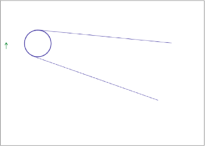
Plate 8
Schematic representation of SM2U: the
upper box
shows the processes modelled in the
energy budget part, with a zoom on the in-street radiation and heat storage processes due to building
walls; the
lower box
shows the modelled water transfer processes. The
black brackets
indicate the
different possible tiles within one grid mesh. Precipitation is a model input while the net radiation
is computed by the model from the incoming global and atmospheric radiation inputs (See also
Figure 6.1 on page 48)


Search WWH ::

Custom Search