Environmental Engineering Reference
In-Depth Information
Colour Plate
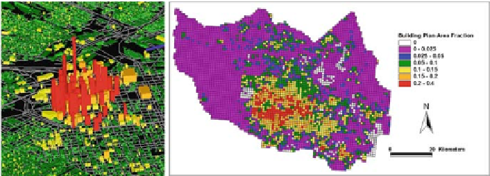
(a)
(b)
Plate 1
1kmsectionofdown-
town Houston.
(b)
Building plan area density, an example of a UCP for Harris County (Houston
Metropolitan area) (cf. Table 1.1) (See also Figure 1.1 on page 4)
(a)
3D building data derived from airborne lidar platform for 1
×
(a)
(b)
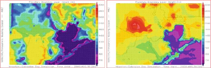
Plate 2
Simulations of mixed layer heights size for 2100 GMT on August 30, 2000 using MM5
with
(a)
UCP and
(b)
standard version of MM5 at 1 km grid (See also Figure 1.2 on page 7)
Search WWH ::

Custom Search