Information Technology Reference
In-Depth Information
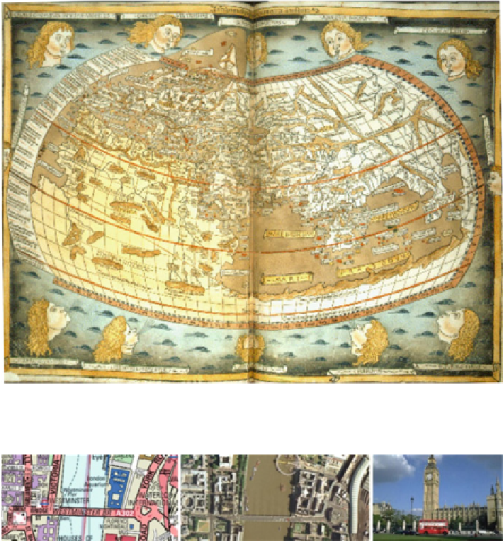
Fig. 2.6
Ptolemy's world map, re-constructed based on his work Geography c. 150 (© The British
Library
http://www.bl.uk/
)
Fig. 2.7
A road map and an aerial photograph of the Westminster Bridge in London
Advances in mineralogy, stratigraphy and paleontology permitted the publication
of the first geological maps in the early nineteenth century, in which colors
were used to indicate the distribution of rocks and soils. Modern world maps,
equipped with satellites and remote sensing technologies, are far more accurate
and informative than the old world maps. Computer technologies now allow users
to make their own maps on the Internet using up-to-date geographic databases.
Cartography has pushed forward the frontiers between the known and the unknown.
Figure
2.7
includes the Westminster Bridge in London on a road map, its aerial
photograph, and a tourist photograph of the Big Ben - a landmark of London.
As we know, cartography is a process of abstraction. The best-known example
is the London Underground map. Figure
2.8
shows an earlier version of London
Search WWH ::

Custom Search