Environmental Engineering Reference
In-Depth Information
SAN
FRENANCO
s
VERDUGO
HILLS
BURBANK
PASADENA
GLENDALE
EL MONTE
BEYEIRLY
HILLS
CSU
LA
UCLA
SANTA
MONICA
LOS
ANGELES
BALDWIN\
HILLS
WHITTIER
HILLS
WATTS
LAX
COMPTON
Legend:
Prop. scrtd
routes
TORRANCE
Freeways
Existing tunnels
ANAHEIM
Hills
−
areas
underlain by
harder rocks
PALOS
VERDES
HILLS
LONG
BEACH
Water table
within 50 ft of
surface (wet subway
construction)
Fault
SLIDE
AREA
Oil field
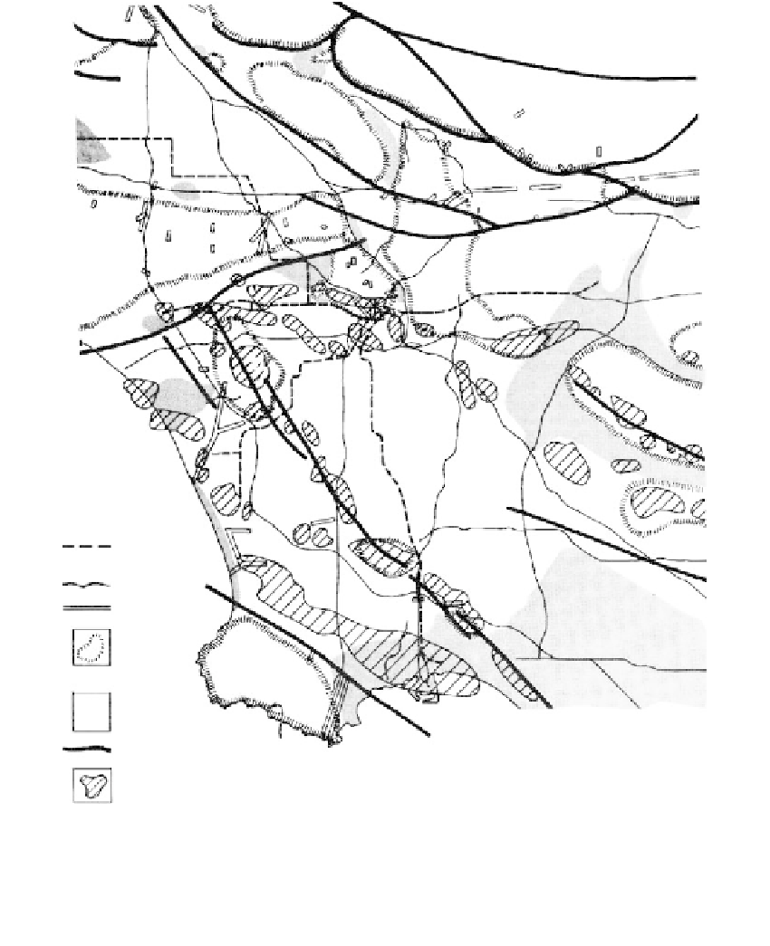
FIGURE 10.3
Water table, faults, and oil fields in the Los Angeles Basin. (From Proctor, R.J.,
Geology, Seismicity and
Environmental Impact,
Special Publication Association Engineering Geology, University Publishers, Los Angeles,
1973, pp. 187-193. With permission.)
Prediction
Prior to the development of a groundwater resource, studies should be made to determine
the water-balance relationship and estimate magnitudes of subsidence. The water-balance
relationship is the rate of natural recharge compared with the anticipated maximum rate
of withdrawal. If recharge equals withdrawal, the water table will not drop and subsi-
dence will not occur. If withdrawal significantly exceeds recharge, the water table will be
lowered.
Estimates of the subsidence to be anticipated for various water-level drops are made to
determine the maximum overdraft possible before surface settlement begins to be trouble-
some and cause flooding and faulting. By using concepts of soil mechanics it is possible to