Environmental Engineering Reference
In-Depth Information
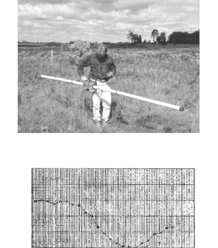
FIGURE 2.36
Terrain conductivity meter (EM31). (Courtesy of Geonics.)
EM34 Data vertical dipole mode quadrature phase
line #15 (8+00)
5.00
4.00
3.00
2.00
1.00
0.00
80.00
90.00
100.00
110.00
120.00
130.00
140.00
Offset (f t)
150.00
160.00
170.00
180.00
190.00
200.00
210.00
FIGURE 2.37
EM34 survey profile to locate a lead-zinc mine ca. 1860: 0U was found to be the location of the mine. (Courtesy
of Woodward-Clyde Consultants.)
Techniques
Continuous subsurface profiling by impulse radar
, also termed electromagnetic subsurface
profiling (ESP), provides a registration of a continuously reflected radar pulse similar
to seismic reflection images. A sled-mounted antenna is towed behind a small vehicle or
boat containing the ESP system. It has been used since 1970 to locate buried sewer lines
and cables, evaluate pavement conditions, detect voids, and profile the bottoms of rivers