Environmental Engineering Reference
In-Depth Information
Elongate
retrogessive
slide
Overlapping toe lobes
Bottleneck slide
Interdistributary
bay
Undisturbed seafloor
Undisturbed seafloor
Pressure ridges
Mudflow
guly
Coalescing
mudflow noses
Collapse depression
Deep normal fault
Mud diapir
Mud/gas vents
River mouth
Shelf edge slump
300 m ~
Large arcuate shelf
edge fault system
Prodelta clays
Undulating
mudflow floor
Remolded sediment
Pleistocene silts and clays
Bar front slumps
(peripheral slumps)
Growth faults
Continental slope
mud diapir
Incipient mud diapir
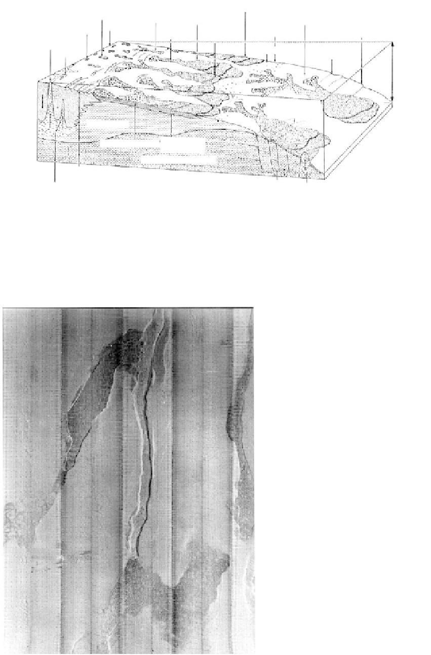
FIGURE 9.58
Schematic block diagram illustrating the various forms of slope failure in the offshore Mississippi River delta.
(From Coleman, J. M. et al.,
Open File Report No. 80.01,
Bureau of Land Management, U.S. Department of
Interior, 1980. With permission.)
FIGURE 9.59
Side-scan sonar mosaic illustrating
seafloor mudflows (offshore Gulf of
Mexico). Grids are 25 m (82 ft) apart and
the mosaic covers an area approximately
1.5 km in length. (Mosaic courtesy of Dr.
J. M. Coleman, Coastal Studies Institute,
Louisiana State University.)