Environmental Engineering Reference
In-Depth Information
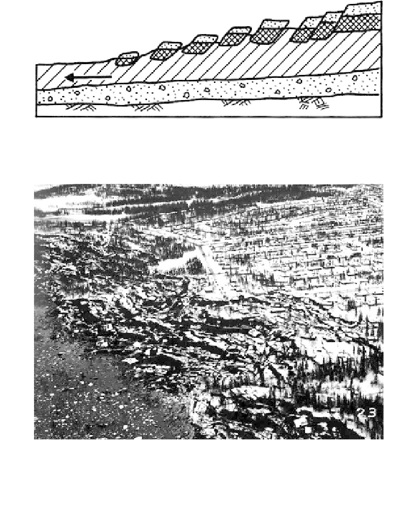
FIGURE 9.43
Stratigraphy after slide at South Nation River. Blocks broke loose and moved by lateral spreading. (After
Mollard, J.D.,
Reviews in Engineering Geology
, Vol. III,
Landslides
, Geological Society of America, 1977, pp. 29-56.)
FIGURE 9.44
Failure by block gliding and lateral spreading resulting from the 1964 earthquake, Turnagain Heights,
Anchorage, Alaska. (Photo courtesy of U.S. Geological Survey, Anchorage.)
planar and evolved by block gliding or slump failure at the bluff, followed by lateral
spreading of the mass for a width of 8000 ft, and extending as much as 900 ft inland.
Geology:
Anchorage and the surrounding area are underlain by the Bootlegger Cove clay
of glaciomarine origin. Soil stratigraphy at the bluff consisted of a thin layer of sand and
gravel overlying a clay stratum over 100 ft thick as shown in
Figure 9.45a.
The consistency
of the upper portions of the clay was stiff to medium, becoming soft at a depth of about
50 ft. The soft zone extended to a depth of about 23 ft below sea level. Layers of silt and
fine sand were present at depths of a several feet or so above sea level.
Slide history:
Seed and Wilson (1967) postulated that cyclic loading induced by the earth-
quake caused liquefaction of the silt and fine sand lenses resulting in instability and block
gliding along the bluff. Blocks continued to break loose and glide retrogressively, resulting