Environmental Engineering Reference
In-Depth Information
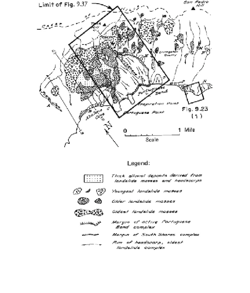
FIGURE 9.36
Distribution of principal landslides and landslide complexes in Palos Verdes Hills, California. (From Jahns,
R.H. and Vonder Linden, C.,
Geology, Seismicity and Environmental Impact
, Special Publication Association
Engineering Geology, Los Angeles, 1973, pp. 123-138. With permission.)
area, the land rises from the sea in a series of gently rolling hills and terraces to more than
600 ft above sea level. The hills beyond the slide area rise to elevations above 1200 ft and
the cliffs along the oceanfront are roughly 150 ft above the sea. A panoramic view of the
slide is given in
Figure 9.38.
Geology
: The slide zone occurs in Miocene sediments (see
Section 7.4.4)
of heavily tuffa-
ceous and sandy clays interbedded with relatively thin strata of bentonitic clays. When
undisturbed, the beds dip seaward at about 10 to 20°, which more or less conforms with
the land surface as illustrated on the section (
Figure 9.39)
.
A badly crushed zone of
indurated clayey silt forming a soil “breccia” (
Figure 9.40)
is found in the lower portions
of the slide area. Present movement of the slide appears to be seated at a depth of about
100 ft below the surface in the “Portuguese tuff,” originally deposited as a marine ash
flow.