Environmental Engineering Reference
In-Depth Information
Glaciers
Stage 3
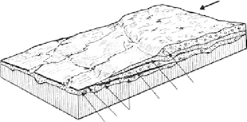
FIGURE 7.80
A stratigraphic section of the last three
stages of glaciation representative of
locations in the midwestern United
States.
Loess
Stage 2
Peat deposit
Gum
botil
FIGURE 7.81
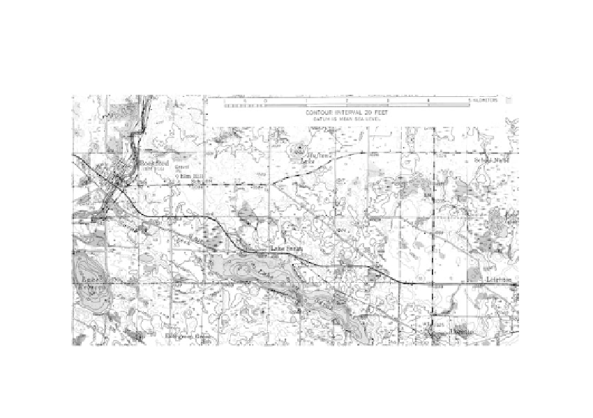
Landform of a pitted till plain (Rockford, Minnesota). (Courtesy of USGS.)
Wisconsinin
till, composed mainly of sands, cobbles and boulders, represents the last
stage of deposition that left most of the landforms typical of continental glaciation.
Landforms
Till plains
are found in Ohio, Indiana, and Illinois, where the topography is characterized
by low relief and usually a considerably flat surface. The till thickness often exceeds 100 ft
and the underlying bedrock surface is irregular. A test boring log from Columbus, Ohio
(see
Figure 7.83a)
,
gives the general stratigraphy.
Pitted till plains
are common features in the north central states. The surface is extremely
irregular, containing numerous lakes and swamps that fill depressions left by melting
blocks of ice as shown in Figure 7.81.
Drumlins
are hills in the shape of inverted spoons found on till plains. They can be com-
posed entirely of till, or mixtures of till and stratified drift, or can have shallow cores of
bedrock which are usually located on their up-glacier end. Drumlin landforms are illus-
trated in
Figure 7.82.
Engineering Characteristics
General
Basal tills can have densities as high as 150 pcf and void ratios as low as 0.21 (Cleaves,
1964). Typical logs of test boring in Ohio, New Jersey, and Massachusetts are given in