Environmental Engineering Reference
In-Depth Information
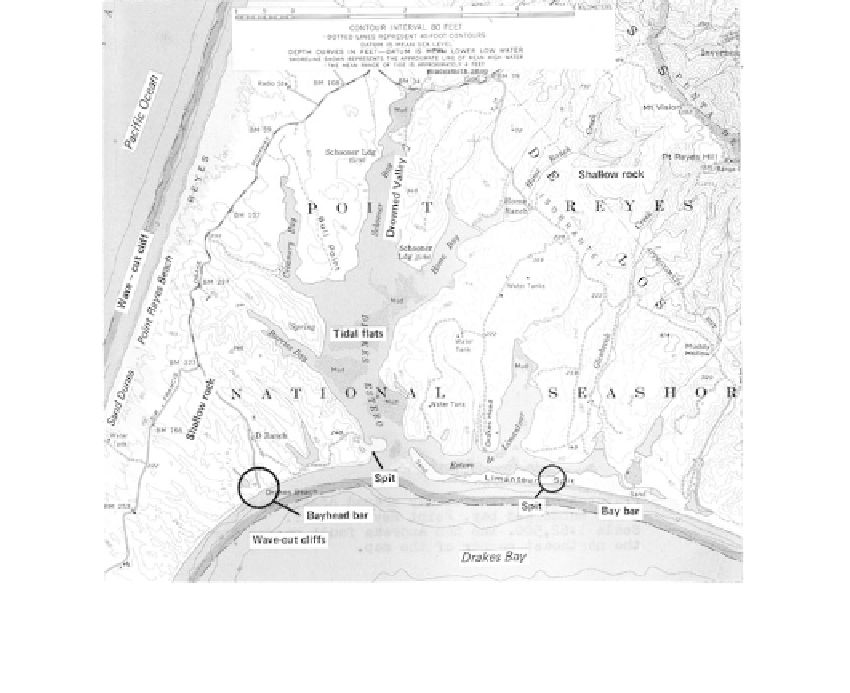
FIGURE 7.49
Features of a structurally shaped coastline and a submerged bay (Point Reyes, California). (Courtesy of USGS.)
7.4.4
Coastal Plain Deposits
General
Coastal plains result from regional uplift, a lowering of sea level, or both, causing the sea
floor to emerge and become land. Geographically, they are defined as regional features of
relatively low relief bounded seaward by the shore and landward by highlands (Freeman
and Morris, 1958). They are of engineering significance as a geologic class because of their
low relief, characteristic engineering properties, and worldwide distribution
(Table 7.8).
There are three major coastal plains in the United States: the Gulf and Atlantic coastal
plains, which cover the largest land area compared with any coastal plain in the world,
and the Los Angeles coastal plain. Their distribution is illustrated in
Figure 7.1.
Nearly all coastal plains contain Quaternary sediments, and most contain Tertiary,
Jurassic, and Cretaceous strata as well. These strata have typically been preconsolidated
under the load of hundreds of feet of material removed by erosion during emergence. L.
Casagrande (1966) reported preconsolidation pressures as high as 10 tsf from a depth of 56
ft in Richmond, Virginia, where overburden pressure was about 2 tsf.
Atlantic Coastal Plain
Landform Characteristics
The Atlantic coastal plain sediments lie unconformably on the Precambrian rocks dipping
seaward and extending out beneath the ocean as shown in
Figure 7.50.
The contact on the
surface between the older crystalline rocks and the coastal plain soils is called the fall line,
and is a characteristic of the Atlantic coastal plain.