Environmental Engineering Reference
In-Depth Information
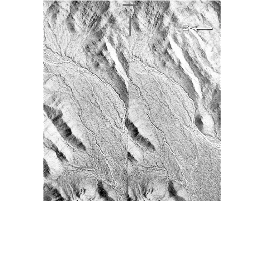
FIGURE 7.30
Stereo-pair of aerial photos at a scale of 1:20,000 covering a portion of the Cañada del Oro near Tucson,
Arizona. (See small-scale stereo-pair in
Figure 2.7.)
The features of erosion and deposition at the base of
mountain slopes in an arid climate are apparent. Upland topography is angular and rugged in the
metamorphic rocks. The myriad of dry-drainage channels results from sheet erosion during flash floods. At
this location, at the apex of an alluvial fan, the soils are predominantly coarse-grained and bouldery.
7.4.2
Estuarine Environment
Estuarine Zone
Located at the river's mouth, the estuarine zone can be affected by the periodic reversal of
the river gradient from tidal activity as well as by flood stages. Sediments are primarily
fine-grained when located at the terminus of the pastoral zone; and channel branches,
islands, and marshes are common.
Deltas
Occurrence
Deltas form where a river enters a large water body and deposits its load in the relatively
quiet, deep waters. As flow velocity decreases, the gravel, sand, and silt particles are segre-
gated and deposited in beds dipping toward the bottom of the water body. The colloidal par-
ticles remain in suspension until a condition of very quiet water occurs to permit
sedimentation. The delta form that occurs is related to the sediment load and the energy con-
ditions of currents and waves. No delta forms when high-energy conditions carry away all
but the coarser particles, which remain as spits and bars along the shoreline (see
Section 7.4.3)
.