Environmental Engineering Reference
In-Depth Information
loads; AF-probable poor support. Areas of GK, GL, GT/GL, and AR in par-
ticular require detailed investigation. (NOTE: Terms such as “moderate loads”
or “poor support” require definition in the report accompanying the map.)
(b)
Excavation conditions
: RX areas will require blasting. High groundwater can
be expected in areas of AF and GL.
(c)
Borrow materials
: Coarse-grained granular soils are found in GK.
(d)
Septic tanks
: High groundwater, clayey soils, or shallow rock over much of
the area imposes substantial constraint to their use.
(e)
Groundwater for potable water supply
: Most feasible locations for wells are at
the base of slopes in the GT and GK materials. Buried channel aquifers may
exist in the valley under the GL deposits.
2.
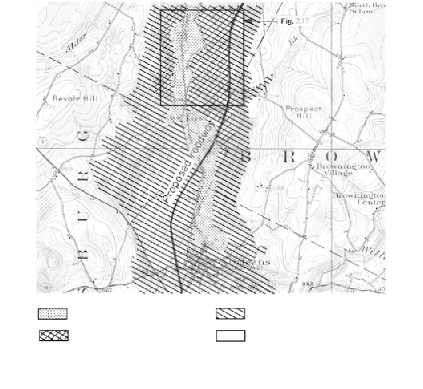
An interstate highway planned for an area with potential slope stability prob-
lems is illustrated in Figure 2.16; slope failures in the area are shown on the
stereo-pair
(Figure 2.17).
A surface photo view of the slide scar area of Figure 2.17
is given in
Figure 9.30.
The area is characteristic of many glaciated valleys in the
northeast United States, which were once the locations of glacial lakes.
3.
A community to receive a new sanitary sewer system is illustrated in
Figure
2.18a.
An aerial photo of the area is given in Figure 2.18b and stereo-pairs in
Al: recent alluvium
Gl: ancient lakebed soils
At
Gl: lacustrine terrace
r x: rock under thin Gm
−
FIGURE 2.16
General engineering geology map prepared for interstate highway through a valley with glacial lacustrine soils on
the slopes (Barton River Valley, Orleans, Vermont). The lower slopes in the At-GL material are subjected to active
movements (see stereo-pair,
Figure 2.17)
;
the upper slopes in overconsolidated GL soils (stiff to hard varved clays)