Environmental Engineering Reference
In-Depth Information
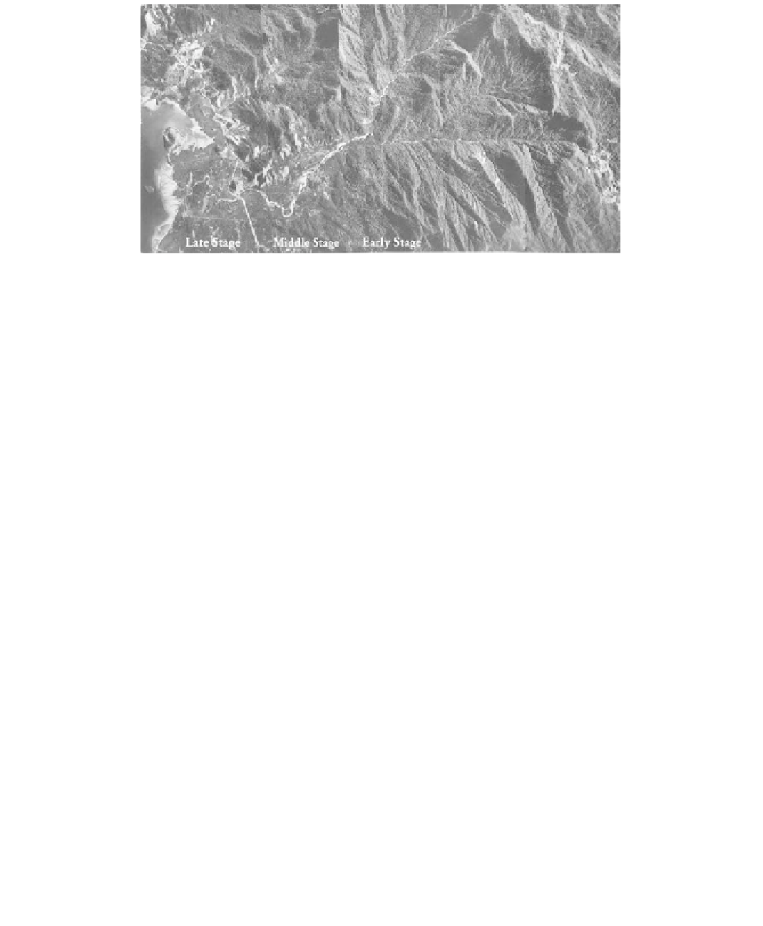
FIGURE 7.16
Aerial photo mosaic of the life cycle of a river: early, middle, and late development stages. Length about 5 km;
environment: crystalline rocks in a sub-tropical climate. See
Figure 7.17
for stereo-pairs of each stage. Each
stage has characteristic soil deposits in and adjacent to the river channel.
Boulder Zone
The boulder zone (Figure 7.17a) represents the early stage of the fluvial cycle. In the
drainage basin the stream density per unit area is low. Youthful streams form the head-
water tract and have V-shaped valleys that can be shallow or deep, and are narrow, sepa-
rated by steep-sided divides.
In the stream, gradients exceed 20 ft/mi (5 m/km), rapids are common, and erosion is
the dominant feature. The stream fills the valley from side to side and degrades or deep-
ens its channel. Stream shape, or alignment, is controlled by geologic structure and can
vary from straight to crooked. Sediments are coarse and bouldery.
Floodway Zone
The floodway zone (Figure 7.17b) represents the middle stage of fluvial development.
The drainage basin contains a well-integrated drainage system with many streams per
unit area. The valleys are deeper and wider with narrow and rounded interstream
divides; local relief is at a maximum, leaving most of the surface in the form of eroded
slopes.
Stream gradients are moderate, ranging from about 2 to 20 ft/mi (1 to 5 m/km). Braided
or shifting channels form an alluvial valley floor, with or without a floodplain, but the
stream no longer fills the valley floor. Pools, ripples, eddies, point bars, sand and gravel
beaches, and channel islands are common. The stream continues to cut into the valley
sides, extending the floodplain, which is formed of relatively coarse soils. Erosion and
deposition are more or less in balance; sediment load is coarse (sand and gravel) and is
greater than or equal to the carrying capacity of the river which is therefore aggrading.
Sediments are stratified.
Pastoral Zone
The pastoral zone (Figure 7.17c) represents the late stage of development. The drainage
basin has developed into a peneplain, and basin drainage is poor. Interstream divides are
areas of low, broad, rolling hills, often with a few erosional remnants such as isolated hills,
or monadnocks.