Environmental Engineering Reference
In-Depth Information
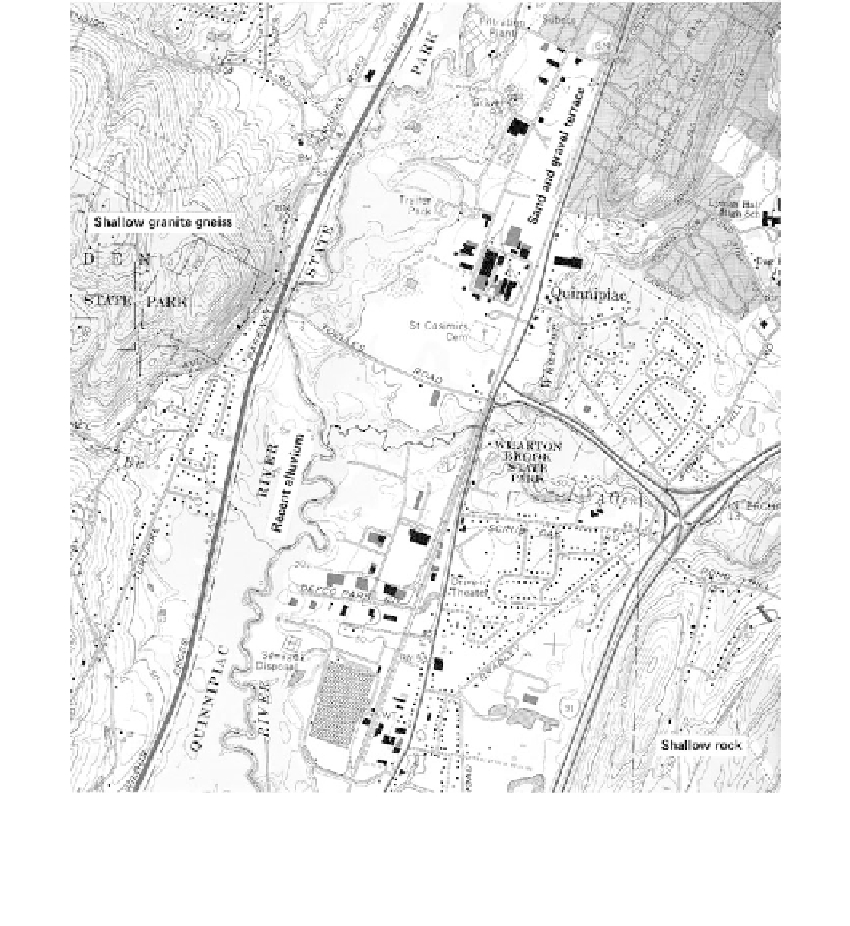
FIGURE 2.14 (
Color Figure 2.14 follows page 396.)
USGS quadrangle map, Wallington, Connecticut (scale 1:24, 000). Map provides detailed information on terrain
features. (Courtesy of USGS.)
shaped form in the upper left is an area of very resistant granite gneiss at shallow depths.
The Quinnipiac River is in its middle stage or floodway zone
(Section 7.4.1),
flowing over
the remnants of a glacial lake bed and depositing fine-grained soils during flood stages
(recent alluvium). The very flat areas, generally between the railroad and the river extend-
ing through the middle portion of the map to about Elev 50, constitute a sand and gravel
terrace formation, which at one time was the valley floor. A gravel pit is noted in the ter-
race formation, and areas of poor drainage (swamps and ponds) are apparent in the right-
hand portion of the map, along Pond Hill Road. These perched water conditions above the
valley floor result from the poor internal drainage of the underlying clayey glacial till.
Engineering Geology Maps
General
Data obtained from terrain analysis can be plotted to prepare an engineering geology
map that provides information on geologic conditions over an entire study area. When