Environmental Engineering Reference
In-Depth Information
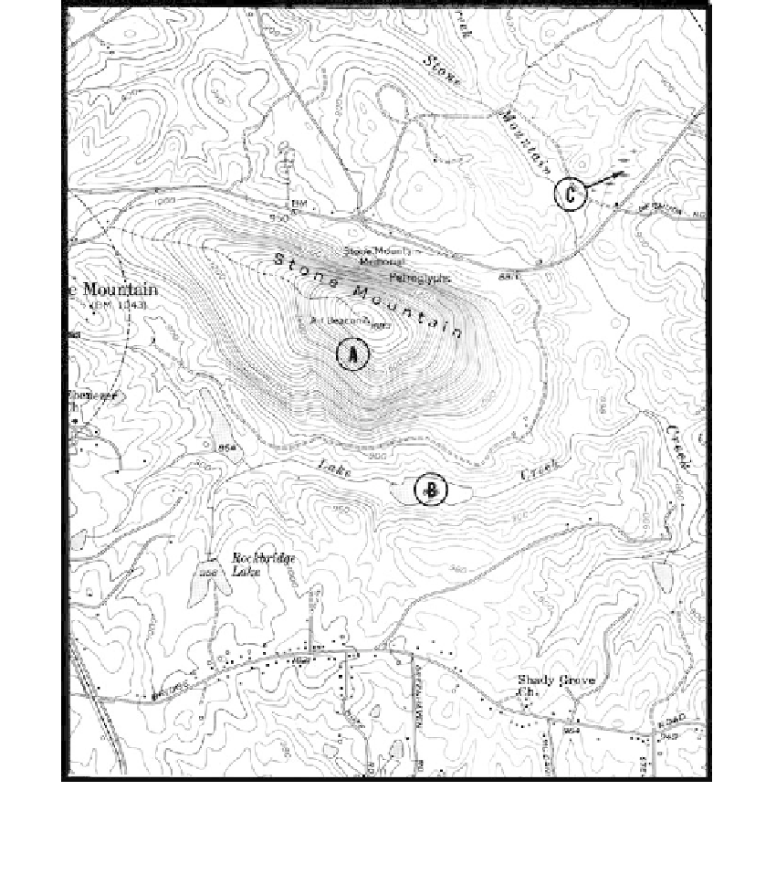
FIGURE 6.73
Differential erosion between a granite mass and surrounding foliated metamorphic rocks has resulted in the
formation of Stone Mountain Georgia. (From USGS topographic quadrangle; scale 1:24,000.) (Courtesy of USGS.)
It is the partially saturated zones where vertical water movement can occur that provide
the optimum conditions for oxidation, reduction, and leaching, and where decomposition
is most active. A relationship between topography and depth of decomposition is illus-
trated in
Figure 6.74,
a location with a warm, moist climate and hilly to mountainous ter-
rain. Average rainfall is more than 80 in. (2000 mm) annually, and the average temperature
is 72
o
F (22
o
C) (mean range is 60 to 104
o
F, or 15 to 40
o
C). Decomposition depth, often to
depths in excess of 100 ft, is greatest beneath the crests of the hills composed of foliated
crystalline rocks. Along the sideslopes, where erosion occurs, the depth is about 30 ft. In
the narrow valleys, where rock is permanently saturated, the decomposed depth is usu-
ally only of the order of 10 ft at the most, and streams often flow on fresh rock surfaces.
The overburden cover is thicker in the wider valleys.
There is little decomposition activity below the permanent water table. Limestone cavities
do not increase substantially in size unless water is caused to flow, for example by well