Environmental Engineering Reference
In-Depth Information
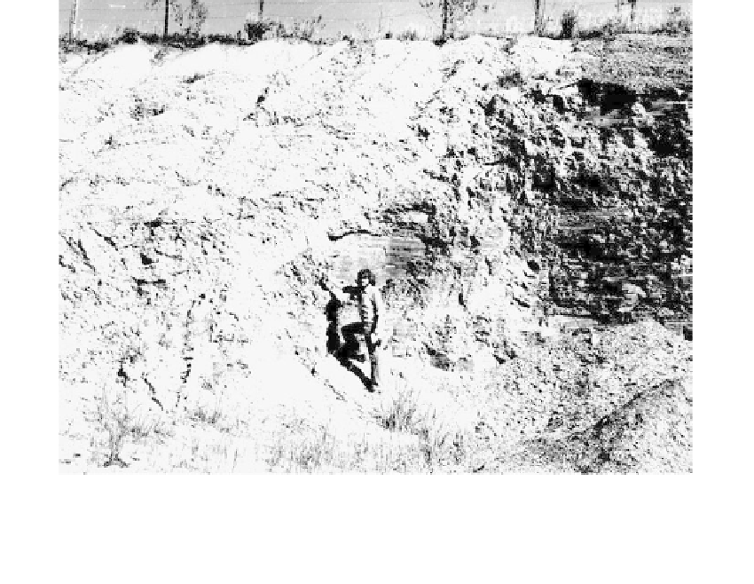
FIGURE 6.62
Thrust fault in Cambro-Ordovician shales exposed in cut (Rio do Sul, Santa Catarina, Brazil).
is made to identify fault scarps, offset drainage, sag ponds, truncated geologic formations,
etc. Stereo and oblique aerial photos taken when the sun is at a low angle clearly delineate
low-fault scarps and other small surface features by shadow effects. Field reconnaissance
is performed to confirm desktop interpretations.
Explorations
Geophysical methods are used to investigate shallow and deep-seated anomalies. The
methods include seismic refraction, seismic reflection, gravimeter measurements, and
magnetometer measurements (see
Section 2.3.2).
Test borings, vertical and inclined, are drilled to explore and sample the suspected fault
zone (see
Section 2.3.5).
Trenches excavated across the postulated fault zone enable close examination of the
overburden soils and the procurement of samples for laboratory testing. Displacement of
Holocene strata is the most reliable indicator of “recent” fault activity.
Laboratory Testing
Radiometric dating of materials recovered from core borings and trenches provides the
basis for estimating the most recent movements. Dating techniques are summarized in
Tables 11.8
and
Appendix A.
Instrumentation
Monitoring of fault movements is performed with acoustical emission devices, shear-strip
indicators, tiltmeters, extensometers, seismographs, etc., as described in
Section 4.5.7.