Environmental Engineering Reference
In-Depth Information
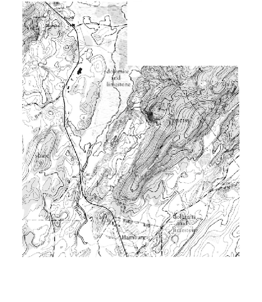
(a)
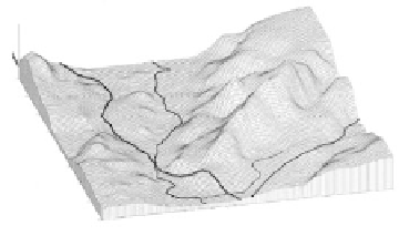
(b)
Wallkill
river
Route 23
160
140
120
100
80
60
Hamburg
40
140
120
20
100
80
60
40
0
20
0
Feet x 100
FIGURE 2.3
(Color Figure 2.3 follows page 396.)
(a)
Portion of USGS Hamburg NJ Quad Sheet, Scale 1”
(1:24000). Area has been glaciated. Shown are
general bedrock types. Note relation to landform shown on inset as evidenced by topography.
(b)
3-D diagram
of topography of Figure 2.3a. (Courtesy of USGS.)
2000
includes a multispectral scanner (MSS) system and an enhanced thematic mapper
(ETM) system. The MSS system, with a spatial resolution of 79 m, has four chan-
nels that record reflected solar energy corresponding to green and red bands and
two near-infrared spectroscopy (NIR) spectral regions. A fifth channel, with a spa-
tial resolution of 240 m, records emitted energy in the thermal infrared region.
The ETM system, with a spatial resolution of 30 m, collects reflected energy in
three visible bands and three infrared bands. The system has one thermal infrared
channel with 60-m spatial resolution. Also included is a panchromatic (black and
white) channel with a spatial resolution of 15 m. Swath width is 185
185 km.
3-D stereo-projections can be prepared from sequentially obtained images.
(Examples of satellite images are given in
Figure 2.5,
and in
Chapter 6.)
SPOT (France): First launched in 1986, SPOT now includes a high-resolution vis-
●