Environmental Engineering Reference
In-Depth Information
4
5
N
0
100
200
n
650
1
2
600
3
4
4
1
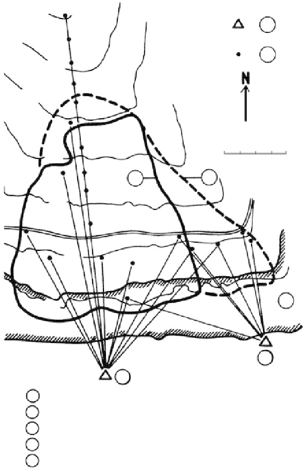
Boundary of old landslide
Demarcation of potential landslide
Sance Reservoir on the Ostravice River
Fixed reference points on the opposite stable slope
Concrete monuments set in monitored slope
2
3
4
5
FIGURE 4.3
Scheme of geodetic control of the Recice landslide. Note that a laser geodimeter was used in the survey
because of significant reduction in measurement time and increased accuracy. (From Novosad, S.,
Bull. Int.
Assoc. Eng. Geol.
, 17, 71-73, 1978. With permission.)
at the control gage. The principle is similar to that of the theodolite, except that the water-
level device is quicker and simpler for working around walls and columns inside build-
ings. Temperature differential, as might be caused by radiators or sunshine affecting the
hose, may introduce considerable error.
Data Reduction
Plots of movements measured periodically reveal the rate and magnitude of differential
settlement or heave within the structure. Determination of total movements requires an
immovable reference point such as a bench mark set into rock.