Environmental Engineering Reference
In-Depth Information
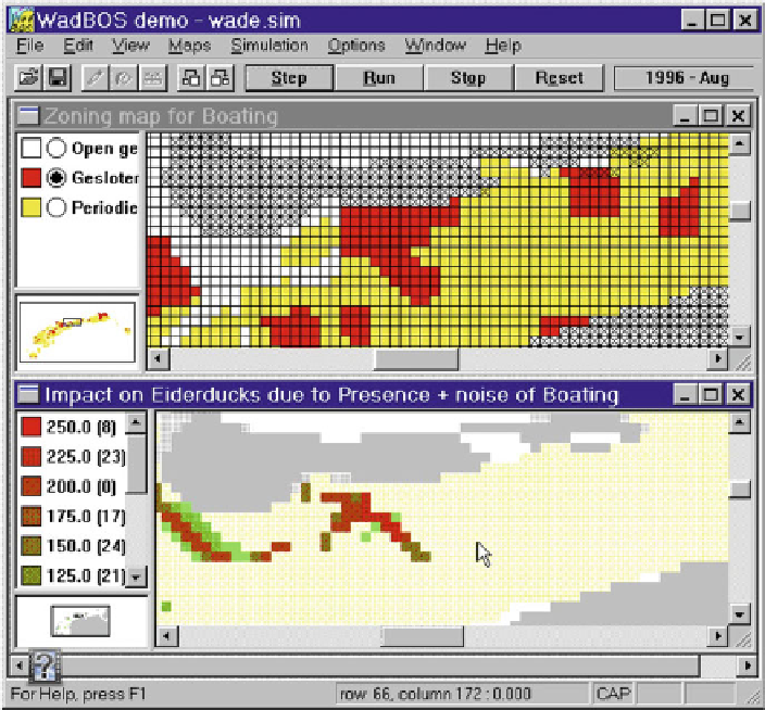
Fig. 22.7 Screenshot of
WadBOS
: Zoning maps for boating in relation to the impact of boating on
Eiderducks
Source
:
http://www.riks.nl
integrated in the
WadBOS
framework allow the (geo)graphical representation of its
dynamic output (Fig.
22.7
). In addition, the system is highly transparent, as a docu-
mentation is available for any module of the system.
WadBOS
can perform different
spatial analyses, however, its communication and learning capabilities are at least as
important.
WadBOS
is an example for a tight coupled IEM, were GIS and submodels
are embedded in an enclosed software environment.
22.5 Conclusions and Future Prospects
GIS enable the assessment of data and models thus facilitating many technical
requirements of model integration. Today, different software and modelling frame-
works offer remarkable capacity for the technical (and conceptual) development of
the Integrated Environmental Modelling (IEM) systems (Filippi et al. 2004).