Environmental Engineering Reference
In-Depth Information
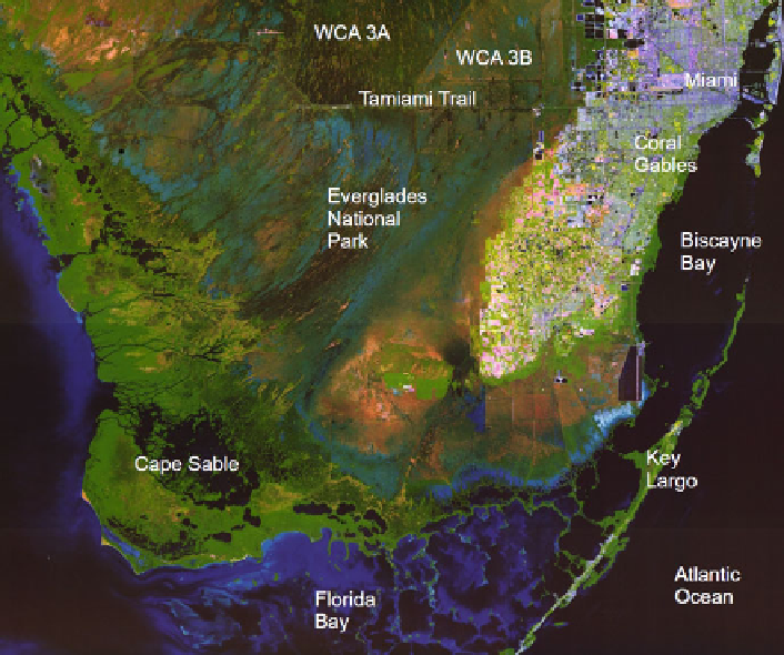
Fig. 21.1 Map of the Southern Everglades, MAP I-2742 by Jones, J., Thomas, JC and Desmond, G.;
courtesy of U.S. Geological Survey (WCA: Water Conservation Area)
water supply for the big cities, including Miami and Ft. Lauderdale, and to develop
the area for residential purposes and for agricultural use. Consequently, a giant
canal system was established to control and carry off water during periods of heavy
rainfall, which altered the water flow from its natural condition.
This system of integrated water regulation and flood control makes use of Lake
Okeechobee as the central water reservoir, which allows large-scale agriculture but
also has drawbacks. Not only do the consequent human-induced major fluctuations
in Lake Okeechobee endanger the aquatic and semi-aquatic communities directly
in the lake, but due to its position upstream of the Everglades, those habitats are
also heavily affected. As side-effects of agriculture, the Everglades ecosystem
receives heavy loading of nutrients, which have had impacts on the vegetation
and wildlife in parts of this originally oligotrophic system. Today, because of
the loss of land and changes in the flow of water, the unique biodiversity of the
Everglades is under strong pressure: the wading bird rookeries and colonies have
drastically declined within the last decades, the Florida panther is endangered, and
the effects are felt by alligators and the fish communities, as well. With the dangers
of Global Change on the horizon, which will bring with it sea level rise, more
extreme weather events, and invasive species, the future of the Everglades is