Environmental Engineering Reference
In-Depth Information
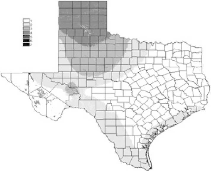
FIGURE 9.9
Wind power map for Texas, 1995.
lands increased. The selection parameters were the same, except for slope (areas with 0-10°) and located
within 16 km of electrical transmission line, ≥69kV, for usable land for wind power (
Figure 9.10
)
.
9D was used and the capacity factor was 30% for class 3 lands and 35% for class 4 and above
lands. The estimates show the large wind potential, even though this amount of capturable wind
power, 172,000 MW, will never be installed when compared to the electrical generating capacity
of Texas, 100,000 MW in 2008. Maps and estimates are available from the Alternative Energy
Institute [29].
A number of wind farms have been built on mesas and terrain with exposure of edges or bluffs.
In one area of West Texas (Pecos, Upton, and Crockett counties), 759 MW of wind farms has been
installed on mesas. The major wind farms, close to 3,000 MW (installed from 2005 to 2008), are located
from Abilene to Roscoe along Interstate Highway 10, and then northwest to Snyder along Highway 84.
Some of these are on so-called mesas, with exposure on one side due to cliffs and bluffs.
The limit of proximity to transmission lines has now changed, as wind farms have been built
within 40 km of major transmission lines. Also, the Texas Public Utility Commission is promoting
new transmission lines to connect the Panhandle with the rest of the state. Without the constraint of
proximity to transmission lines, the estimate for the amount of intercepted wind power is 850,000
MW with a capturable wind power around 270,000 MW. If offshore winds are included, then the
estimate would be even larger.
9.5.3 W
IND
P
OWER FOR THE
U
NITED
S
TATES
Similar estimates have been made for the United States, regions and states. Winds of class 4
and above [30] with access to transmission lines are the most common criteria. The
State Wind
Search WWH ::

Custom Search