Travel Reference
In-Depth Information
Consult your map and get off N-56, following the Horn Head signs all the way around
the eastern lobe of the peninsula. There are fewer than eight kilometers (5 miles) of nar-
row, single-lane road out here, with very little traffic. But be alert and willing to pull over
at wide spots to cooperate with other cars.
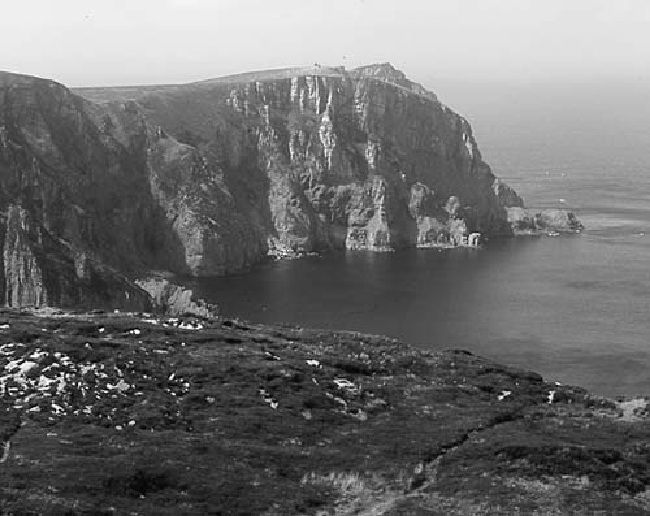
This stone-studded peninsula was once an island. Then, shortly after the last Ice Age
ended, ocean currents deposited a sandy spit in the calm water behind the island. A hun-
dred years ago, locals harvested its stabilizing dune grass, using it for roof thatching and
sending it abroad to Flanders, where soldiers used it to create beds for horses during World
War I. However, with the grass gone, the sandy spit was free to migrate again. It promptly
silted up the harbor, created a true peninsula, and ruined Dunfanaghy as a port town.
A short spur road leads to the summit of the headland, where you can park your car and
walk another 50 yards up to the abandoned WWII lookout shelter. The views from here are
dramatic, looking west toward Tory Island and south to Mount Errigal. Some may choose
to hike an additional 20 minutes across the heather, to the ruins of the distant signal tower
(not a castle, but instead a lookout for a feared Napoleonic invasion), clearly visible near
the cliffs. New hiking trails are being created on the peninsula. But from here, it's still easy
to bushwhack your way through (in sturdy footwear) to the rewarding cliff views at the