Travel Reference
In-Depth Information
39.5 km:
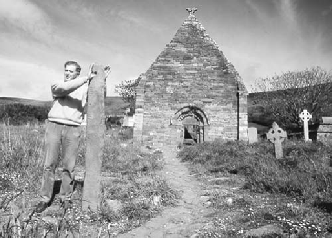
The
ruined church of Kilmalkedar
(Cill Mhaoilcheadair, on the left) was
the Norman center of worship for this end of the peninsula. It was built when England
replaced the old monastic settlements in an attempt to centralize their rule. The 12th-cen-
tury Irish Romanesque church is surrounded by a densely populated graveyard (which has
risen noticeably above the surrounding fields over the centuries). In front of the church,
you'll find the oldest medieval tombs, a stately early-Christian cross (substantially buried
by the rising graveyard and therefore oddly proportioned), and a much older ogham stone.
This stone, which had already stood here 900 years when the church was built, is notched
with the mysterious Morse code-type ogham script used from the third to seventh centur-
ies. It marked a grave, indicating this was a pre-Christian holy spot. The hole was drilled
through the top of the stone centuries ago as a place where people would come to seal a
deal—standing on the graves of their ancestors and in front of the house of God, they'd
“swear to God” by touching thumbs through this stone. You can still use this to renew your
marriage vows (free, B.Y.O. spouse). The church fell into ruin during the Reformation. As
Catholic worship went underground until the early 19th century, Kilmalkedar was never
rebuilt.
40.2 km:
Continueuphill,overlookingthewater.You'llpassanother“fairyfort”(Ciher
Dorgan) on the right dating back to 1000
B.C.
(free, go through the rusty kissing gate). The
bay stretched out below you is Smerwick Harbor. In 1580 a force of 600 Italian and Span-