Geoscience Reference
In-Depth Information
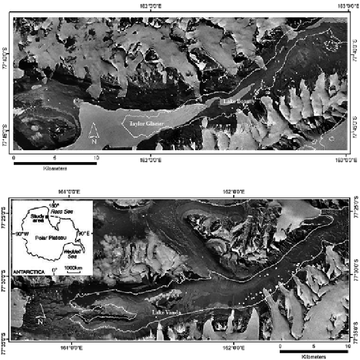
Fig. 11.11
Location of soil pits above and within the proposed upper elevations of Glacial Lakes
Taylor and Wright by Hall et al. (
2000
,
2001
). Maps from Bockheim et al. (
2008
)
Bockheim et al. (
2008
) and Bockheim and McLeod (
2013
) hypothesized that
soils above the uppermost paleolake levels should be more strongly developed and
contain more salts than soils below. In central Taylor and Wright Valleys, soils on
equivalent-aged drifts above and below the conjectured upper limits of Glacial
Lakes Washburn (336 m) and Wright (550 m), respectively, are all well developed
with no appreciable differences in their properties (Fig.
11.11
). Moreover, there
were no signifi cant differences in the slopes of regression equations relating soil
property to age of the parent materials above and below the high-water lake levels
(Fig.
11.12
). Other than small alluvial fans with algae at all elevations, they found
no evidence of former lake sediments nor did they fi nd high-level strandlines except
for strandlines on the north valley wall ca. 50 m above Lake Vanda, ice-shove
features, or paleo-shore features. In Victoria Valley, a regression analysis of depth of