Global Positioning System Reference
In-Depth Information
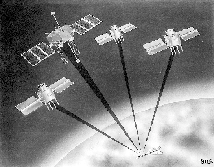
Fig. 4.6. nts-2 satellite and first gps demonstration constellation. An artist's render-
ing of nts-2 and three subsequent navigation development satellites, which
together created the first demonstration gps constellation, giving users longitude,
latitude, altitude, and time. (Courtesy Naval Research Laboratory)
mented the plan by working on the gps Block i satellites and the receiver equip-
ment. A major problem gps managers continually faced was convincing some
military leaders and many in Congress that this satellite navigation system's
costs were worthwhile. Civilian applications would eventually be plentiful, but
no civilian money supporting the program was forthcoming. Parkinson retired
from the jpo and the military in 1978. Sonnemann commented about Parkin-
son's time leading the gps program: “The Air Force jpo under Col. Parkinson
did an excellent job in implementing gps. Until the capability of the system
was demonstrated and verified, no significant funds could be expected to be
committed from non-dod [Department of Defense] government organiza-
tions or the civilian potential users of gps, so it would have been very difficult
to speed up the process.”
34
In sum, when the documentary record and the recollections of those who
differ with Parkinson's narrative are considered, a more complicated picture
emerges. These sources reveal that the synthesis of competing satellite navi-
gation approaches resulted from a long, complex interservice negotiation. That
Search WWH ::

Custom Search