Geography Reference
In-Depth Information
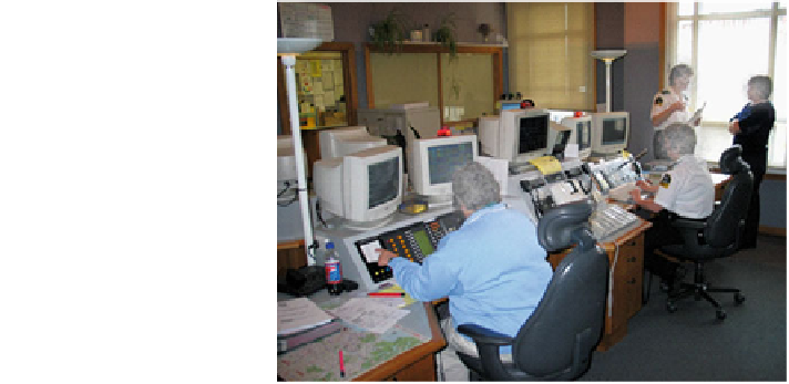
Fig. 1 The SRCC dispatcher
setup (from Hayes
2006
)
and Invercargill, and the rest are in small towns and rural areas. In the commu-
nications centre, two dispatchers are present during normal operating conditions.
Usually when an emergency call arrives the dispatchers work in tandem. One takes
details of the incident from the caller whilst the other allocates resources when the
key details regarding the incident (location, severity) become available (Fig.
1
).
4.2 The SRCC Displays
The Computer Aided Dispatch (CAD) system supporting the SRCC is relatively
low-tech and consists of two primary displays for each dispatcher and a shared
secondary display (for less frequently used volunteer crews). The purpose of the
first display is to facilitate the entering and retrieval of information regarding
emergency incidents. The second display provides the operators with the status of
emergency vehicles and the jobs that they have been assigned to. This display is a
text-based list and emergency vehicles are grouped together based upon their 'home
station'. For example all the vehicles based at the Dunedin station are grouped
under this heading. In support of the dispatcher set up, there is a further computer
behind the dispatchers that has an electronic map of the southern region. This is
used to locate addresses operators are not familiar with and provide GPS coordi-
nates of, and route information to, an accident, if the ambulance crew needs it. The
order of the ambulance station list on the second display betrays some regional
groupings of stations (Fig.
2
a) but is not geographically true for the province as a
whole (in terms of topology, and given the list format a geometric representation is
obviously not viable). Two studies have compared the efficiency and effectiveness
of the existing display with a topologically true display, both with and without
linking lines as an abstraction of the state highway network (Fig.
2
b and c). In terms
of cognitive science and interface design, the proposed geographically agreeable
displays follow the Proximity Compatibility Principle (PCP).