Geography Reference
In-Depth Information
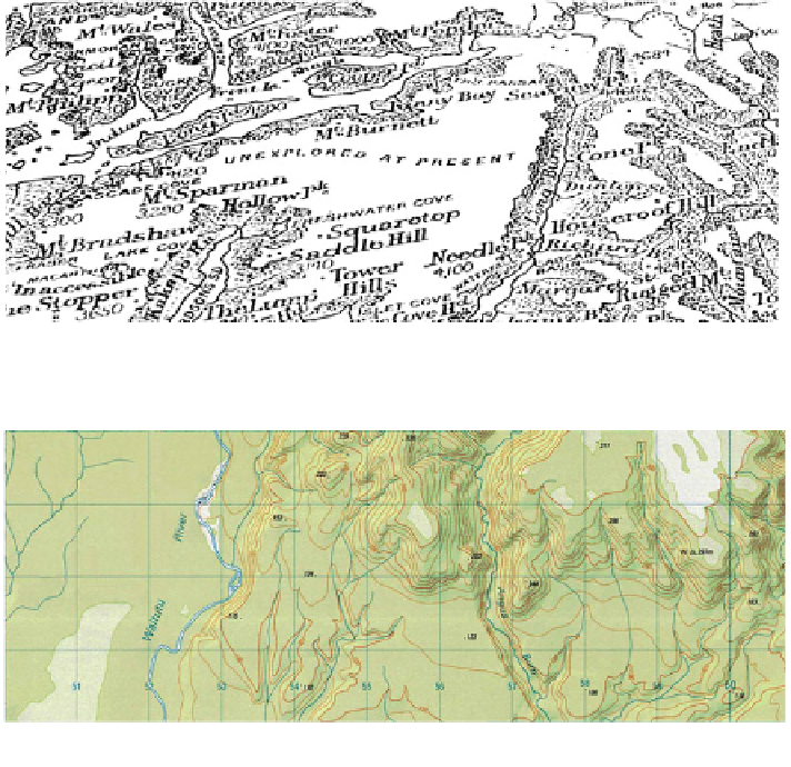
Fig. 1 Excerpt from map accompanying Moir's Guide to the Southern Lakes. Note the words in
the centre stating 'unexplored at present' (Moir
1925
)
Fig. 2
Extract taken from Infomap 260 Series Map B45, Edition 1 1995
results from these very broad definitions, coupled with the precision of GIS
database standards, is a homogenization rather than differentiation of the multiple
qualities of the forest, rivers, flats and mountains to be found there. Indeed it can
be argued that this singular treatment is not dissimilar to the use of white by the
first coastal surveys to describe a similarly barely-discernible blank interior.
Other absences also exist. Histories that relate to past and present activities of
people are left unidentified because of the adoption of a cartographic instruction
that notes only selected structures. In New Zealand's national parks, only those
facilities maintained for visitors are shown. Huts, bridges and tracks maintained
for large-budget conservation management programs but not available for public
use are excluded; likewise many wharfs, mines, tramlines, and settlements of only
archaeological significance remain unidentified. This is at odds with the region's
history, in which the sheltered harbours and plentiful fish meant the region was a
popular base for pre-European M¯ori, and also for early European settlers who
extensively prospected and mined the region. Today it is recreational fishers,
hunters and hikers who routinely set up camps here.