Geography Reference
In-Depth Information
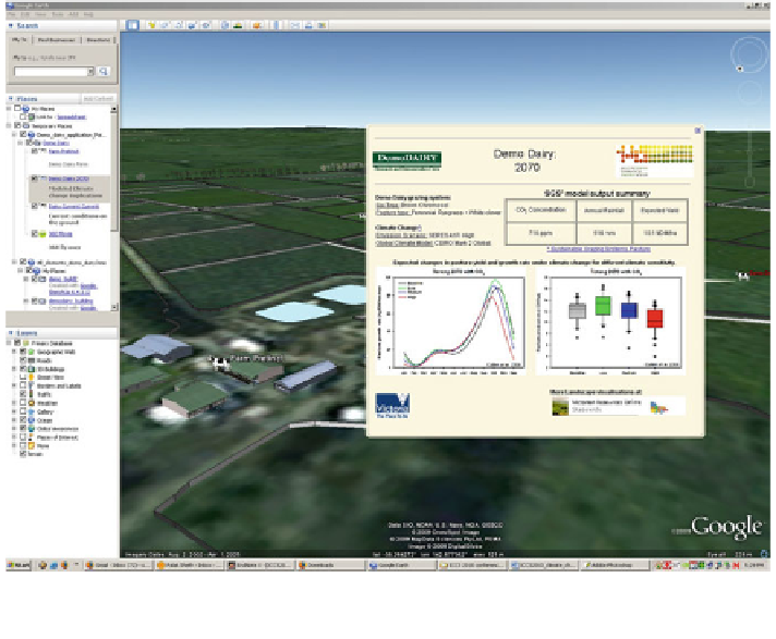
Fig. 3 Illustration of Google Earth placemark at the local scale presenting results from a locally
run SGS pasture growth model
incorporated multiple placemarks localised within the Demo Dairy farm bound-
aries by using Northgate's KML editor (
http://www.northgates.ca/kmleditor/
)
to
create each placemark and format its associated HTML balloon content. These
placemarks (see Fig.
3
) were used to provide point and click access to text, table
and graph information. This information was categorised as:
• general information relative to the existing Demo Dairy farm and management
practices. Developed to assist users to better understand the current environment
and farming conditions.
• outputs from a locally calibrated pasture growth (SGS) model (Cullen et al.
2008
). This model was run for different climate change scenarios and reported
likely impact on pasture yield and growth pattern (Fig.
3
).