Geoscience Reference
In-Depth Information
• Context - The association and site location
of objects are often important for aiding
interpretation. Note land cover and land use
as clues to help identify related features in
the scene, and refer to existing maps or
census data for ancillary information.
3.2.2 Wetland image interpretation
Water, vegetation and soil are the principal fea-
tures of interest for interpretation of wetland
imagery. Water is the most widespread feature
on the surface of the Earth, and water bodies
exist in many forms
-
seas, lakes, rivers, ponds,
estuaries, bayous, lagoons, etc. In aerial photo-
graphy, water color is most obvious, and the
color of water bodies is a good indication of
suspended sediment. Clean water rel ects blue
light weakly, but rel ectance drops off sharply
for green and red light and is essentially zero
for infrared radiation. Thus, clean water typi-
cally looks dark blue or sky colored in visible
imagery (Fig. 3-3). Suspended sediment inl u-
ences the color of water, which depends on the
sediment composition and turbidity (Fig. 3-4).
Aerial photography of water bodies often dis-
plays sun glint and glitter (Fig. 3-5). Although
usually considered undesirable, under some
conditions sun glint is advantageous for identi-
fying small water bodies that otherwise would
be difi cult to distinguish. Conversely, sun glint
Each of these basic features is seldom recognized
on its own. Rather it is the combination of visual
elements that allows interpretation of objects
depicted in aerial photographs. With these factors
in mind, a perceptual measure of image quality
or interpretability has been developed
-
the U.S.
National Imagery Interpretability Rating Scale
(NIIRS). An image rating depends on the most
difi cult interpretation task that can be accom-
plished (Table 3-2). Levels 1-3 represent the
largest and most generalized features, which cor-
respond to regional and macro levels (
10 m) of
mire classii cation (see Table 3-1). The middle
three interpretability levels (4-6) are at the meso/
micro levels (
>
10 cm to 10 m), and the highest
interpretability levels (7-9) represent the micro
and sub-micro classes (
>
<
10 cm).
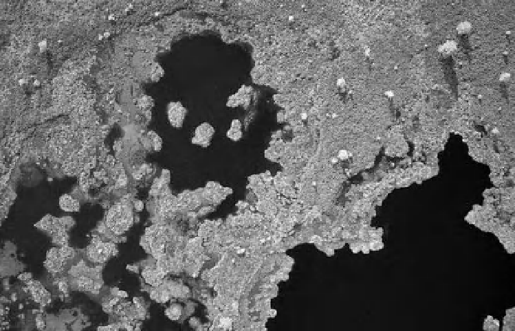
Figure 3-3.
Close-up vertical view of pools in the Nigula Bog, Estonia. Open water bodies are essentially black, as
the clear water rel ects almost no sunlight. Dwarf pine trees cast shadows on hummocks between pools. Kite
airphoto by S.W. Aber and J.S. Aber.