Geoscience Reference
In-Depth Information
Figure 1-9.
Presque Isle is a sandy spit that extends from the mainland into Lake Erie in northwestern
Pennsylvania, United States (see Color Plate 1-9). The transition from sandy shore, to shallow water, to deep lake is
depicted in this panoramic view looking toward the northeast. Kite aerial photo by J.S. Aber and S.W. Aber.
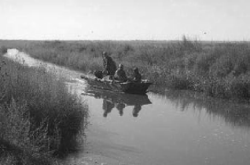
Figure 1-10.
Hunters in a camoul aged “duck boat”
return from a venture in the marsh at Cheyenne Bottoms,
central Kansas, United States. Photo by J.S. Aber.
surface of the world, depending upon the dei ni-
tion for what is included (Mitsch and Gosselink
2007). Bog, swamp, marsh, fen, muskeg, and
similar habitats are represented in this total. The
broader dei nition of Ramsar (see chapter 2)
includes lakes, rivers, and coastal marine water
bodies (up to 6 m deep), which pushes the
wetland coverage to more than 12 million km
2
.
Peatland (mire) includes those types of wetlands
that accumulate peat at least one foot (30 cm)
in thickness (Fig. 1-12), which may happen in
swamp, bog, muskeg, and fen environments.
Peatlands cover approximately 4 million km
2
worldwide (Dugan 2005).
Figure 1-11.
U.S. postage stamp issued in 1957 depicts
a family of whooping cranes. Original stamp printed in
blue, brown, and green colors. From the collection of
J. Vancura.
Wetlands of diverse types are found in all
land and coastal regions of the world; however,
the distribution of wetlands is certainly not
uniform (Fig. 1-13). The greatest concentration
of wetlands is found in boreal and subboreal