Geoscience Reference
In-Depth Information
global-scale inl uences. Changes in ice-albedo
feedback and the release of stored greenhouse
gases, such as CO
2
and CH
4
, from melting and
disintegrating permafrost may further feed into
global climate change (Callaghan et al. 2005).
Moreover, such processes would impact wet-
lands directly across the Arctic.
mounds of ice cores covered by earth, are
common as are other thermokarst features.
The summer transforms this area from a
frozen snow- and ice-covered plain into an
extensive wetland drained by several rivers, with
a shallow layer of thawed soil, numerous lakes,
and abundant wildlife and plant communities. At
the surface, the soil layer varies in thickness
between about 35 cm and 4 m and freezes and
thaws seasonally (Martin et al. 2009). Below this
active layer, permafrost may extend to a depth
below 600 m. Permafrost typically prevents water
percolation into the ground. Spring l oods and
overland river l ows inundate vast sections of the
coastal plain, feeding a landscape of thousands
of lakes, troughs, shallow depressions and
polygonal features (Fig. 17-28). These l oods
turn the plain into a highly productive system
supporting enormous species densities and
hosting hundreds of species of plants, mammals,
insects, birds, and i sh.
The vegetation of the Arctic Coastal Plain
takes advantage of the long daylight hours
during the brief summer to leaf-out within a
17.4.1 Arctic Coastal Plain, Alaska
The North Slope of Alaska extends above 68° N
latitude and covers a vast area almost to the
Canadian border to the east, the Chukchi Sea to
the west, the Beaufort Sea on the north, and the
Brooks Range to the south. The northernmost
section of the North Slope includes the Arctic
Coastal Plain, which stretches across 50,000 km
2
of l at tundra landscape with a short two-to-
three month summer, when July temperatures
average around 10 °C (Martin et al. 2009). Ice
plays a signii cant role in molding this Arctic
landscape. It gives rise to open polygonal per-
mafrost features roughly 5 to 10 m across caused
by subsurface ice wedges. Pingos, or elevated
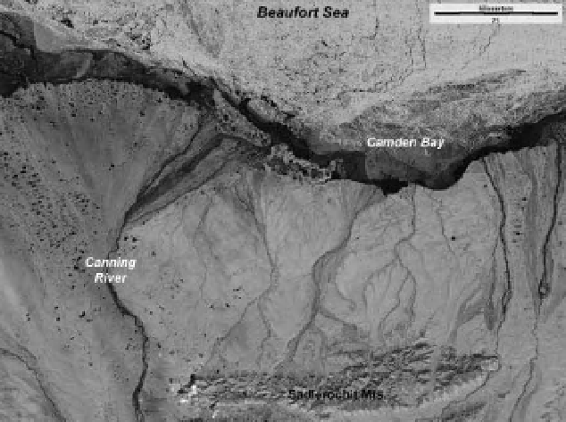
Figure 17-28.
Satellite image of a portion of the North Slope region, including the Canning River and its delta,
north of the Sadlerochit Mountains, northeastern corner of Alaska, United States (see Color Plate 17-28). Land
vegetation is just beginning to green up (yellow-green), and sea ice (cyan) has pulled away from the shore in this
early summer scene. Small lakes and streams are ice-free (black), but larger lakes and rivers still have partial ice
cover. Most of this area is part of the Arctic National Wildlife Refuge, including the coastal plain 1002 Area, as well
as Kaktovik Inupiat Corporate Lands. Landsat ETM
+
bands 1, 4 and 5 color coded as blue, green and red. Image
date 6 July 2000. Image from NASA; processing by J.S. Aber.