Geoscience Reference
In-Depth Information
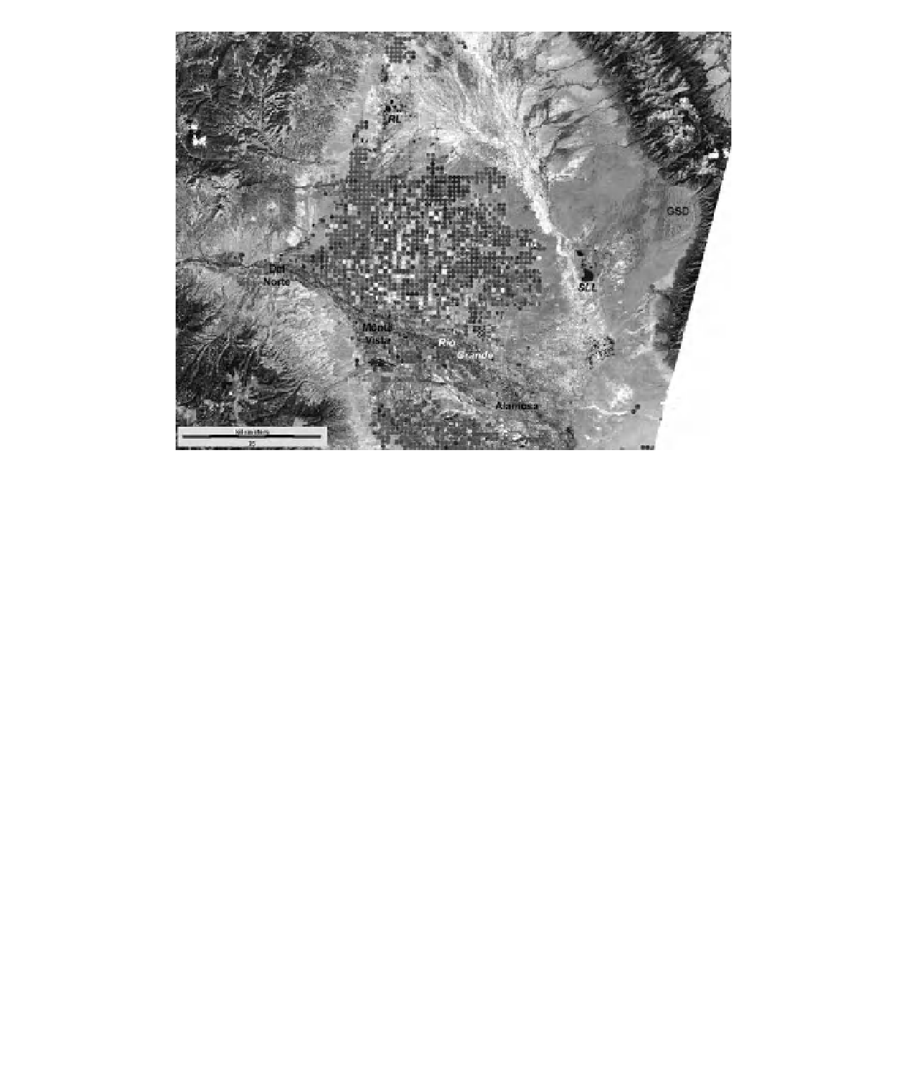
Figure 17-20.
Satellite image of the central portion of San Luis Valley (see Color Plate 17-20). The region north and
east of the Rio Grande is an internal basin draining into several lakes. GSD - Great Sand Dunes, RL - Russell
Lakes, SLL - San Luis Lake. Landsat TM bands 2, 5 and 7 color coded as blue, green and red. Active vegetation
appears green. Acquired 21 August 2009. Image from NASA; processing by J.S. Aber.
A
B
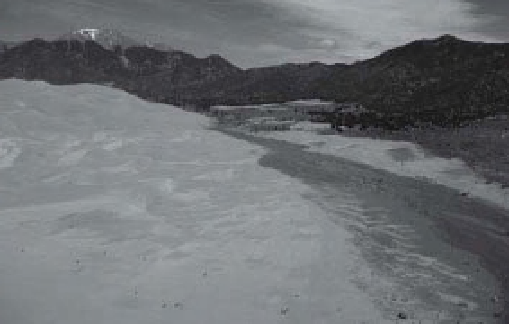
Figure 17-21.
Water in vicinity of the Great Sand Dunes, Colorado, United States. A. Medano Creek drains from the
Sangre de Cristo Range in the background, l ows beside the southern edge of the Great Sand Dunes, and soaks
into the sandy sediment. Note people for scale. B. San Luis Lake in foreground with the Great Sand Dunes in the
distance against the Sangre de Cristo Range. Ground water recharged from Medano Creek at the Great Sand Dunes
emerges downslope to replenish the lake. Great Sand Dunes exceed 2500 m elevation; San Luis Lake is
<
2300 m
altitude. Kite aerial photos by S.W. Aber and J.S. Aber.
shorebirds in the San Luis Valley are similar to
pre-European accounts (U.S. Fish and Wildlife
Service 2010c).
Russell Lakes State Wildlife Area is an excel-
lent example of relatively natural wetland
habitats in the northwestern portion of San Luis
Valley. Russell Lakes SWA consists of 2159
acres (
∼
874 ha), just under 7600 feet (2340 m)
elevation, including numerous marshes, pools
and intervening subtle dunes (Fig. 17-25). The