Geoscience Reference
In-Depth Information
formed over the past 3000 to 4000 years behind
a barrier spit which shelters it from the Gulf of
Maine's strong tidal and wave action (Dionne,
Dalton and Wilhelm 2006). The reserve is bor-
dered by agricultural i elds, tree cover, beaches,
high-value ocean-front real estate, and intensive
urban development (Fig. 16-38).
During the nineteenth and twentieth centu-
ries, tidal restrictions such as roads, culverts
and dikes reduced tidal exchange and frag-
mented and changed the coni guration of these
marshes (Dionne, Dalton and Wilhelm 2006).
However, recent conservation efforts have
sought to restore marsh functions (see Color
Plate 2-16). Periodically conducted surveys
report a diverse estuarine system with more
than 260 recorded bird species, 93 species of
l owering plants, 57 i sh species and 288 inver-
tebrates (Dionne, Dalton and Wilhelm 2006;
Wells Reserve 2011).
The reserve's wetlands comprise a complex
mix of species that loosely follow the typical
species gradient pattern observed across New
England coastal marshes. Tall form
Spartina
alternil ora
is dominant along creek edges.
Away from creek edges and across sections of
the high marsh,
S. patens
is dominant or
16.3.1 Wells Reserve, southeastern Maine
Along southern coastal Maine, the Wells National
Estuarine Research Reserve (NERR) is an exam-
ple of a small yet productive salt-marsh system
supporting wide l oral and faunal diversity. The
NERR program is administered by the National
Oceanographic and Atmospheric Administration
(NOAA) and includes a system of monitored
coastal ecosystems across the United States. The
Wells Reserve is the culmination of several con-
servation efforts, starting with the establishment
of the Coastal Maine National Wildlife Refuge,
renamed the Rachel Carson National Wildlife
Refuge (NWR) in the 1960s (see Preface, Fig. 1).
In 1984, the Laudholm Trust, formed by con-
cerned citizens and residents, along with NOAA
purchased farmland surrounding the Rachel
Carson NWR. This entire conservation area was
eventually listed a NERR site in 1986 (Dionne,
Dalton and Wilhelm 2006).
Today the Wells Reserve serves a mix of edu-
cational, scientii c and conservation functions
(Wells Reserve 2011). It includes approximately
910 hectares of salt marsh across the Webhannet
and Little River estuaries and is managed by
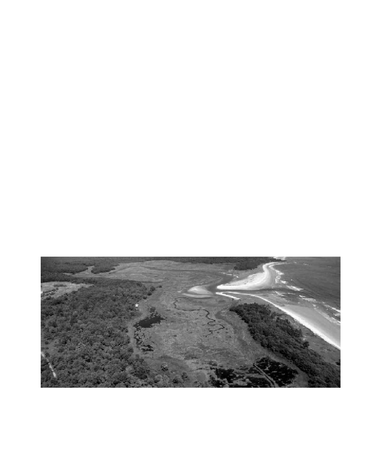
various agencies (Fig. 16-37). The marsh was
Figure 16-37.
Panoramic view over Laudholm beach and the mouth of the Little River at the Wells National
Estuarine Research Reserve on the Atlantic coast of southeastern Maine, United States. Aside from the beach, a path
through the forest (lower left), and a small observation platform (*), this wetland environment is closed to the
public. Superwide-angle view looking northward; blimp airphoto by J.S. Aber, S.W. Aber and V. Valentine.