Geoscience Reference
In-Depth Information
continues at i ve other plants, making Saskatch-
ewan a world leader in naturally produced
sodium sulfate. Few large commercial deposits
of such salt exist outside this region of North
America (Slezak and Last 1985).
Severe loss of wetlands and declining water-
fowl were recognized as serious environmental
issues, when Canada and the United States
agreed to the innovative North American Water-
fowl Management Plan (NAWMP) in 1986, and
Mexico joined the plan in 1994 (Dugan 2005).
The plan involves many partners and funding
A
B
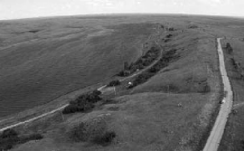
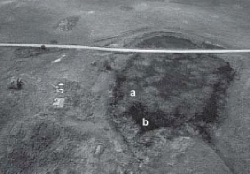
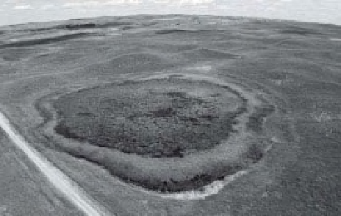
Figure 16-30.
Pothole wetlands in the Dirt Hills,
southwest of Regina, Saskatchewan, Canada. A.
Abandoned farmstead (left) and a small marsh (right).
The marsh is almost completely ini lled with a mosaic
of cattail (a) and bulrush (b); only a small area of open
water remains on the far side of the township road. B.
Another pothole in hummocky moraine. Note
distinctive vegetation zones; the pond is largely
covered by algae. Kite airphotos by S.W. Aber and J.S.
Aber.
Figure 16-31.
Lake Oro occupies a deep kettle hole.
This depression formed when glacial melt-water l oods
buried a stagnant block of ice in sand and gravel.
Later, when the ice melted, a pronounced depression
was left in the outwash plain. Lake Oro is today a
small regional park near Crane Valley, Saskatchewan,
Canada. Kite airphoto overview by S.W. Aber and J.S.
Aber.
Figure 16-32.
View across shallow lake and cattail-marsh in Lake of the Rivers spillway at Ardill, Saskatchewan,
Canada. This is a favored nesting site for many duck species. Photo by J.S. Aber.