Geoscience Reference
In-Depth Information
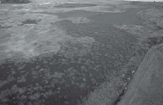
A
A
B
Figure 16-21.
Azolla
bloom in TNC marshes, Cheyenne Bottoms, Kansas, United States (see Color Plate 16-21).
Comparable views both taken in mid-October. A. 2009.
Azolla
indicated by maroon color; cattle in lower right
corner. B. 2010. Cattail (green) is prominent;
Azolla
is not evident in this aerial view, but small patches were
observed on the ground at the edges of the marsh. Blimp and kite airphotos by J.S. Aber, S.W. Aber, G. Corley and
B. Zabriskie.
10,000 years, most importantly during the mid-
Holocene climatic optimum, some 8000 to 5000
years ago, and again from about 3000 to 1500
years ago (Swinehart 1990).
Thick dune sand rests on unconsolidated
alluvial sand and gravel that cover poorly con-
solidated Ogallala strata, all of which are parts
of the High Plains aquifer system. Throughout
nearly all of the Nebraska Sand Hills, the satu-
rated thickness of the aquifer is at least 100 m,
and it exceeds 150 m in the central portion
(Bleed 1990). This represents the greatest
volume of water storage in any portion of the
High Plains aquifer and is a key for understand-
ing wetland hydrology in the Sand Hills. Essen-
tially wetlands occur everywhere the water table
intersects the land surface in swales and troughs
between the dunes. Throughout the sand hills,
cattle ranching is the primary land use, based
mainly on wet meadows (Fig. 16-25).
This immense ground-water reserve is sus-
tained by precipitation that averages about 0.5 m
per year through the central portion of the sand
hills (Wilhite and Hubbard 1990). Toward the
west precipitation falls to less than 0.4 m per year;
to the east it rises to about 0.6 m per year. This