Geoscience Reference
In-Depth Information
A
B
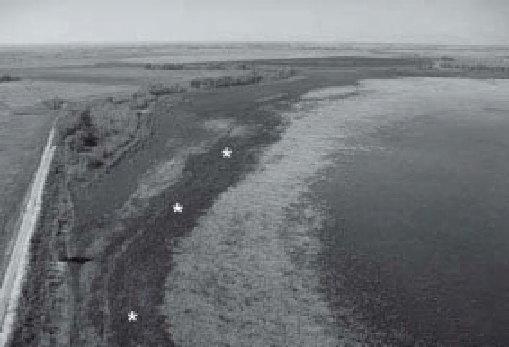
Figure 16-7.
Irrigation water in vicinity of Lakin, Kansas. A. Amazon Ditch and water-l ow structure. B. Lake
McKinney during a drought year with low water level. Road on left runs along the dam. The band of dark vegetation
(*) is curly dock (
Rumex crispus
), a facultative wetland plant. Photos by J.S. Aber and S.W. Aber.
Figure 16-8.
High-spatial-resolution, shaded-relief topographic map derived from lidar elevation data showing
pocosin basins in vicinity of Rex, southeastern North Carolina. Elongated basins trend NW-SE. Multiple ages of
basins are shown by overlapping patterns, and small streams have eroded valleys into some basins. Highways and a
railroad run diagonally across the scene. Map covers
600 km
2
; adapted from original color image by M. Davias;
obtained from Wikipedia Commons
<
http://commons.wikimedia.org/
>
.
∼
Carolina Bays, which are found on the Atlantic
Coastal Plain from Virginia to northern Florida
(Cleveland 2008). Pocosins are elongated, oval
basins that occur in parallel sets or trains and
are located on uplands between stream valleys
(Fig. 16-8). As for playas, wind is considered to
have played a major role in the formation of
pocosin basins (Blair 1986).
Several internal drainage basins are situated
immediately north of the Arkansas River valley
in western and central Kansas. Various tectonic
and sedimentary processes may be responsible
for isolating these basins from the Arkansas
drainage system, including subsurface solution,
ini ltration of i ne sediment, animal activity
(buffalo wallows), wind action, meteorite impact,