Geoscience Reference
In-Depth Information
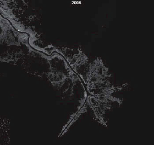
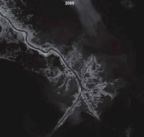
Figure 15-19.
Satellite images of the Mississippi River delta vicinity immediately before (15 Oct. 2004) and after
(16 Sept. 2005) Hurricane Katrina and four years later (29 Oct. 2009). Compare with image from 1985 (Fig. 15-17).
Note changes particularly evident for Breton Island, Pass á Loutre, Southeast Pass, South Pass, and the area on the
southwestern side of the Mississippi River. Based on Landsat TM band 4 (near-infrared), which is particularly
sensitive to emergent vegetation (light gray) and water bodies (black). Image from NASA; processing by J.S. Aber.
frequency. Hydrocarbon production is most
likely to continue for decades, considering the
U.S. dependence on fossil fuels (Sever 2010).
Given these trends, it seems inevitable that the
Mississippi Delta and Louisiana Gulf coast
would continue losing substantial ground to the
sea; another 700 km
2
of wetlands are forecast to
disappear within the next half century (Dugan
2005). Already many larger mammals, such as
the jaguar (
Panthera onca
) and black bear
(
Ursus americanus
), are in jeopardy.
Hurricanes Katrina and Rita in 2005 and the
BP Deepwater Horizon oil spill in 2010 severely
damaged coastal wetlands stretching from Loui-
siana to western Florida. Human population
and economic activities endured great losses.