Geoscience Reference
In-Depth Information
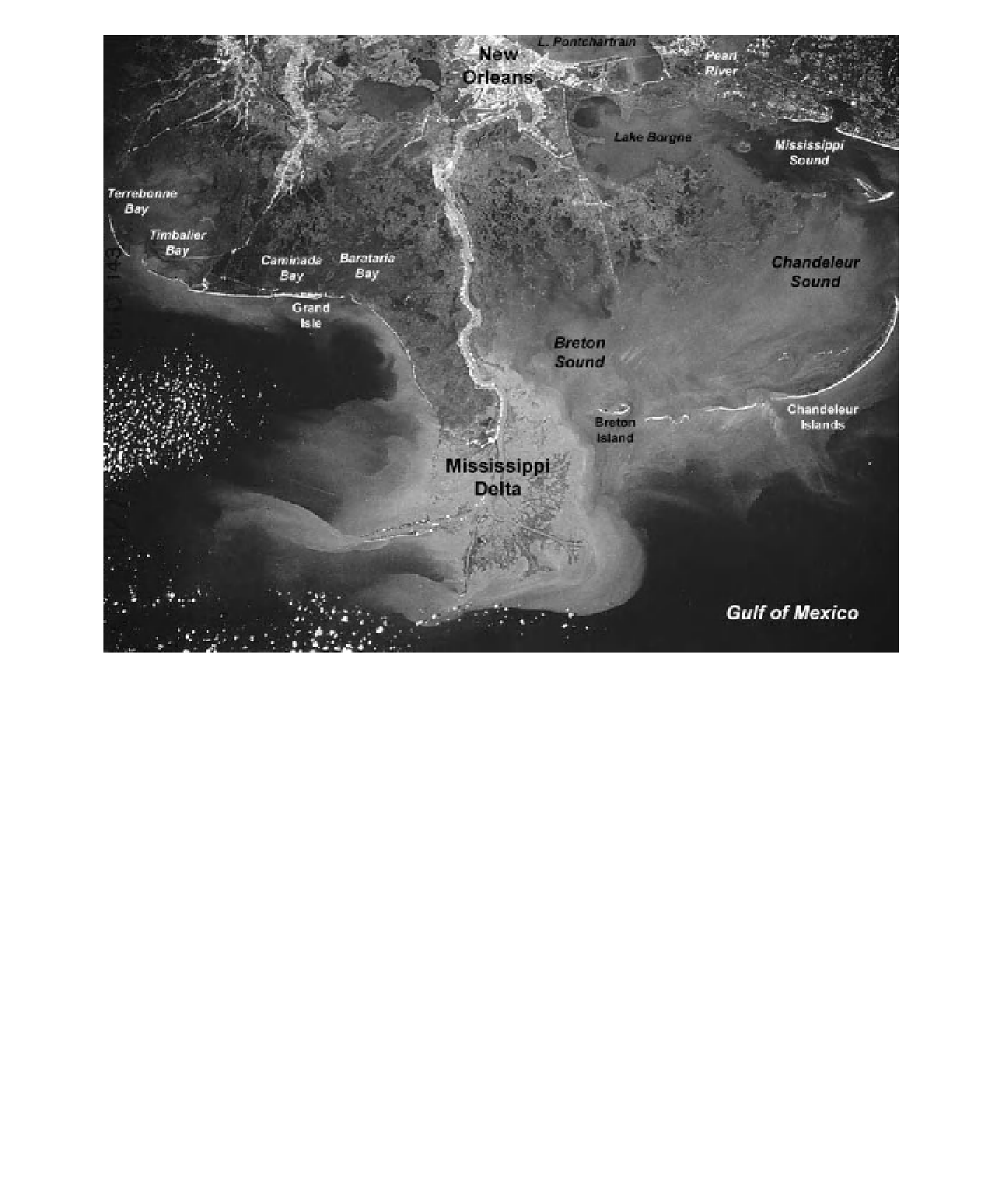
Figure 15-16.
Manned space photograph of the New Orleans and Mississippi River delta vicinity. Note the nearly
symmetrical arrangement of barrier islands, bays, sounds, and lakes on either side of the delta. This image was
acquired in January 1985, before a series of hurricanes all but destroyed the Chandeleur Islands and parts of the
delta complex. Image courtesy of K. Lulla; STS-51C-143-027.
5000 km
2
) has been con-
verted from emergent wetlands to open water
(Nyman 2010). The rate of loss was greatest
during the 1960s and 70s, averaging one hectare
every 55 minutes; the rate slowed to approxi-
mately one hectare every 95 minutes during the
1980s and 90s (Nyman 2010). Many natural and
human causes contribute to the current loss of
fresh-water wetlands and intrusion of the sea:
∼
to the sea via Atchafalaya Bay. Dredging to
deepen the navigation channel leads to increased
l ow velocities, so that sediment is transported
far offshore into deep water. For many decades,
dredged spoil from the main channel was
dumped at the head of Pass á Loutre, which has
effectively clogged the pass and cut off the l ow
of fresh water and sediment into this distribu-
tary system. According to Nyman (2010, p. 12),
Pass á Loutre is dying as a distributary channel,
and the Pass A Loutre Wildlife Management Area
is dying as a wetland habitat. This situation is
symptomatic of the entire delta complex.
Coastal Louisiana is rapidly losing marshes
and swamps. Since the 1930s, an area roughly
the size of Delaware (
• Eustatic rise in sea level - Current sea level
is rising approximately 3 mm per year glo-
bally due to gradual melting of land-based
glaciers and thermal expansion of ocean
water (see chapter 8.3.4). This process is