Geoscience Reference
In-Depth Information
volunteers from the United States and Canada
to engage in a systematic bird survey based on
a set methodology along thousands of kilom-
eters of roads within the two countries (U.S.
Geological Survey (USGS) 2007). Volunteers
methodically record every bird vocalization or
sighting at several predetermined stops along
an assigned 39.2 km route. At each stop, a vol-
unteer spends a few minutes recording birds
within a 400 m radius. As the North American
BBS mission statement suggests, this survey is
to provide “scientii cally credible measures of
the status and trends of North American bird
populations at continental and regional scales
to inform biologically sound conservation and
management actions” (USGS 2007, p. 2).
The British Trust for Ornithology (BTO), a
non-proi t, citizen-science organization in the
United Kingdom has been conducting a similar
BBS across the country since 1996 (British Trust
for Ornithology 2011a). Civilian volunteers are
trained to collect data and monitor changes of
some 100 bird species on randomly sampled
1 km
2
sites across the United Kingdom. The BTO
survey includes three i eld visits over the breed-
ing season with an average visit time of
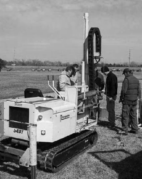
Figure 3-34.
Constructing a ground-water monitoring
well in l oodplain alluvium with a Geoprobe direct-
push drilling rig. Campus of Emporia State University,
Kansas, United States. Photo by J.S. Aber.
Figure 3-35.
Experimental prairie plots designed to test how different treatments (burning, mowing) may inl uence
vegetation and wildlife. Each plot measures 30
×
30 m; small pond in upper right corner of view. Plots are sampled
periodically on the ground and documented by aerial photography. Kite aerial photo by S.W. Aber and J.S. Aber;
Kansas, United States.